
Maxwell Falls
A tiered waterfall on Maxwell Creek in the Arapaho National Forest, a few miles south of Evergreen, Colorado, and about 45 minutes from Denver.
Open.
Day use only. No entry between sunset and sunrise. No camping, no campfires.
Fire: Stage 1 fire restrictions in effect through December 31, 2026. No charcoal grills; gas or liquid-fuel stoves are OK.
Shooting: Recreational shooting is prohibited under Forest Service Order 02-10-00-25-02, in effect until rescinded.
Rules last checked September 2026. Current conditions
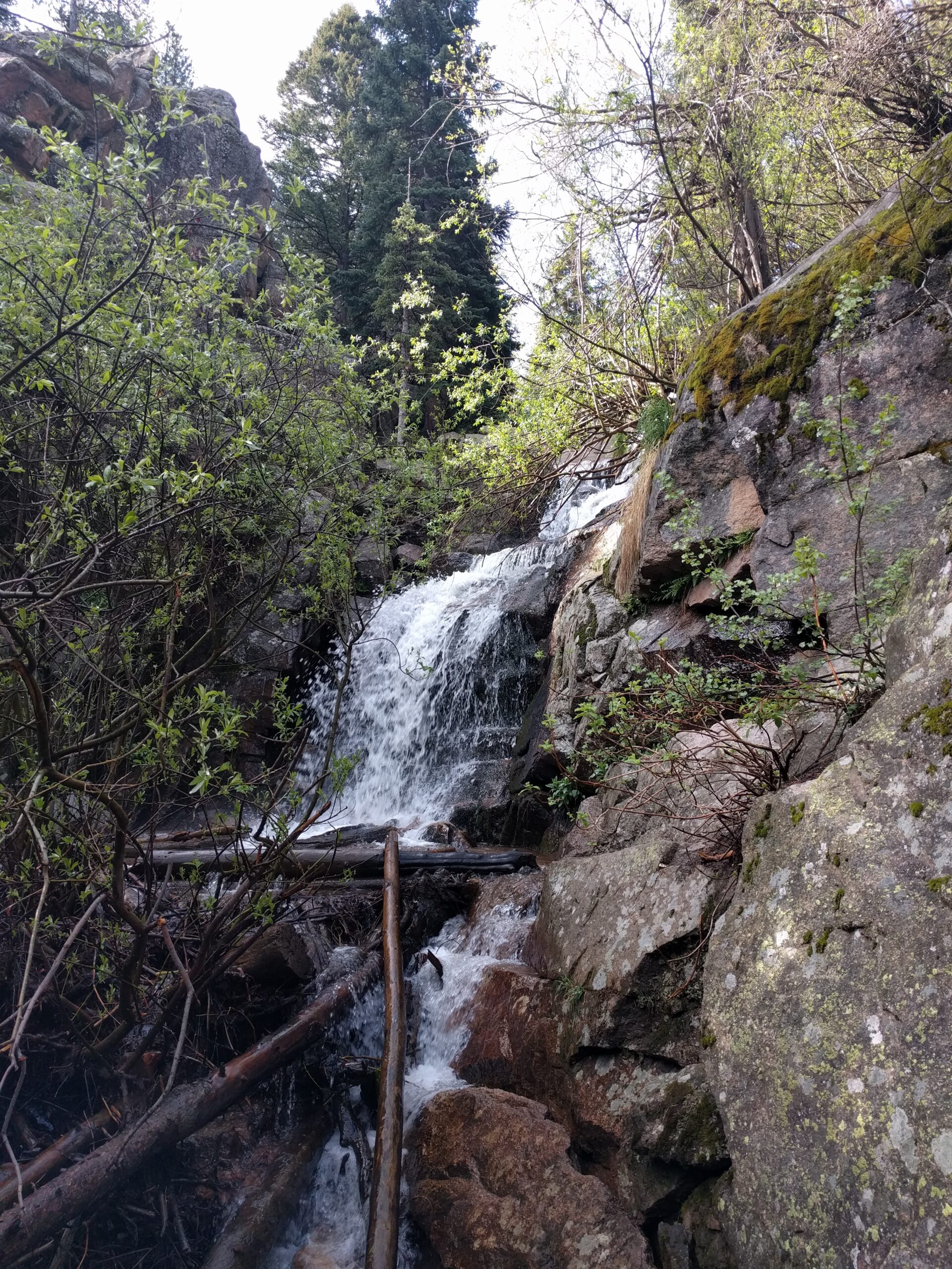
A waterfall hike in the forest above Evergreen
Maxwell Falls is a tiered waterfall on Maxwell Creek, in a canyon of lodgepole and ponderosa pine a few miles south of downtown Evergreen. It sits on National Forest land, costs nothing to visit, and is about 45–50 minutes from Denver. You can reach it two ways. The upper trailhead gets you there in a short walk; the lower one is a longer, hillier hike.
We’re the Friends of Maxwell Falls, a few neighbors who live down the road, and we keep this guide current. When a rule matters, we link to the Forest Service page it comes from.
Know before you go
Climb
~260 or ~850 ft
Upper: all of it on the walk back. Lower: up, down, then up again. Route details
Parking
Free, small lots
About 15 cars each, plus a lower overflow lot. They fill fast on summer weekends. Road parking only where legal, fully past the white line. Trailheads
Dogs
Hand-held leash
Forest Service rule and county law (fines up to $1,000). Pack out every bag; never leave one at the trailhead. Rules
Facilities
None
No restrooms, no water and no trash service at any trailhead. Pack out everything, dog bags included. Safety
Choose your route
The short walk from the upper lot
About 0.6 miles each way from the upper trailhead. The trail drops gently through the trees to the falls, which means the easy half comes first and the climb (about 260 ft) waits for the walk back to the car. Most families and first-timers start here.
The longer hike from the lower lot
About 1.7 miles each way from the lower trailhead, with roughly 850 ft of total climbing round trip. The trail climbs to a saddle, drops to a footbridge over Maxwell Creek, then follows the creek up to the falls.
The Cliff Loop
This side loop climbs past rock outcrops and an overlook before dropping back to the creek near the falls. About 2.4 miles from the upper trailhead, or about 4.5 miles as a loop from the lower trailhead.
| Route | Distance | Climb | Est. time | Difficulty | Start |
|---|---|---|---|---|---|
| Upper trail to the falls (out and back) | 0.6 mi one way / 1.1 mi RT | ~260 ft, all on the return | 30–45 min | Easy, with a steady climb back out | Upper trailhead |
| Lower trail to the falls (out and back) | 1.7 mi one way / 3.4 mi RT | ~850 ft RT | 1.5–2 h | Moderate | Lower trailhead |
| Lower trailhead loop with the Cliff Loop | 4.5 mi loop | ~1,150 ft | 2–2.5 h | Moderate, short steep pitches | Lower trailhead |
| Cliff Loop from the upper trailhead | 2.4 mi loop | ~580 ft | 1–1.5 h | Moderate, short steep pitches | Upper trailhead |
| Full trail, one way (two-car shuttle) | 2.25 mi one way | Uphill direction ~890 ft; downhill direction ~240 ft | 1–1.5 h | Moderate | Either trailhead, car at the other |
| Road between the lots (not recommended on foot) | 2.8 mi one way | ~710 ft walking up from the lower lot | About 1 h, in traffic | Not a hiking route | See the road warning |
Distances follow OpenStreetMap trail lines (© OpenStreetMap contributors); climb comes from USGS 3DEP 1 m lidar and is good to about 10–15%. Times are moving time plus a short stop at the falls. How we measured
Two trailheads, two small lots
Map © OpenStreetMap contributors. Trail signs are few: photograph the trailhead map before you start.
The lower trailhead is on South Brook Forest Road, about 3.6 miles from Highway 73. The upper trailhead is off Black Mountain Drive, about 2.8 miles farther by car. Both lots are small and free (about 15 cars each), with no restrooms and no water, and there’s no trash service at any trailhead. They fill fast on busy summer days, especially weekends and holidays. The lower trailhead has an overflow lot, and you can park along Brook Forest Road where it’s legal and safe, with the car completely past the white edge line (Colorado law). Parking details.
Please don't walk the road between trailheads.
It’s 2.8 miles on Brook Forest Road and the connecting roads, with no sidewalk or shoulder along much of it, 25–30 mph traffic on blind curves, and spotty cell data. Hike out and back, set up a two-car shuttle, or pick a loop that returns to your own car. Why this matters
What to expect by season
Late spring and early summer bring the best water. Snowmelt peaks and the falls run at their fullest.
Summer weekends are busy. Flow drops as the season goes on, and afternoon thunderstorms are routine.
By fall the falls are down to a trickle, but the trails are quieter and the aspens along the Cliff Loop turn in late September.
In winter the falls often freeze, and the trail is usually snowy or icy from December into spring. Bring microspikes.
The four notes that matter most
These have been on the site since 2018. Nothing we’ve learned since has knocked them off the top of the list.
Dogs on the trail
The Forest Service requires dogs to be on a hand-held leash here. Bring water for your dog and carry every waste bag back out. A bag left at the trailhead “for later” is still there a week later, and the neighbors notice. Dog rules
Pack it out
There is no trash service at any Maxwell Falls trailhead: no cans and no pickup. Everything you bring in, including dog bags, orange peels and wet wipes, goes home with you.
Stay on the trail
Social trails braid through the canyon, and off-trail ground near the falls and the cliffs is steep, with loose rock and soil. Stick to the signed trail. It’s safer, and the hillsides stay put.
Be prepared
Mountain weather turns fast, and a sunny start can end in hail or snow. Wear layers. Carry water and a snack, even on the short walk.
Day use only
The Forest Service order for Maxwell Falls and nearby Cub Creek Trail makes this a day-use area: no camping, no campfires, and no one in the area between sunset and sunrise. Stage 1 fire restrictions also apply through December 31, 2026 (no charcoal grills; gas or liquid-fuel stoves are OK), and recreational shooting is prohibited under a permanent Forest Service order. Read the rules and the reasons behind them.
If the lot is full
Both trailheads have small, free lots that fill fast on busy summer days, especially weekends and holidays. The lower main lot holds fewer than 18 vehicles and its overflow lot beside the road about 15 to 20. The upper lot holds about 15, with a little roadside parking on Black Mountain Drive below it. If there’s no space:
- Park on the road only where it’s legal and safe. Parking along Brook Forest Road is allowed where it’s sensible, safe and not signed “No Parking.” Those signs mark the stretches where the shoulder is too narrow. Both tires on the road side must be completely off the road, past the white painted edge line: Colorado law bars parking on the main-traveled part of a highway, and the “roadway” doesn’t include the shoulder. Never block a travel lane or a driveway (Jefferson County parking rules).
- Expect tickets on busy days. The Jefferson County Sheriff’s Office enforces parking here, and neighbors see cars ticketed most crowded weekends.
- Try the other trailhead, about 2.8 miles away by car. See Trailheads and parking.
- Come back before 8 a.m. or on a weekday. Either one makes a big difference.
- Hike somewhere else. Evergreen has good alternatives, and Jefferson County Open Space posts live parking levels for its parks. See Hikes near Evergreen.
Questions visitors ask
How long is the hike to Maxwell Falls?
From the upper trailhead it's about 1.1 miles round trip; from the lower trailhead it's about 3.4 miles round trip. See the route comparison for climb and time.
Which trailhead is better?
The upper trailhead is shorter and easier for kids, but you climb back out at the end. The lower trailhead is a real hike with more variety. Compare them.
Is there a fee or a permit?
No. Parking and the trail are free, and no reservation is needed. Trailhead details.
Are dogs allowed?
Yes, on a hand-held leash, per the Forest Service. Dog rules.
Can I camp or have a fire?
No. Maxwell Falls is day use only, with no camping and no campfires. Under the Stage 1 fire restrictions that run through December 31, 2026, a gas or liquid-fuel stove is OK and a charcoal grill is not. Rules.
Make a day of it
- The interactive trail map shows the whole trail system, and you can download a GPX before you go.
- Nature and history covers the 1.4-billion-year-old granite underfoot, the wildflowers and the Brook Forest story.
- Evergreen Lake and downtown are a short drive away. See Evergreen.
- If you collect waterfalls, we keep a short list of waterfall hikes near Denver.
Who made this guide
Friends of Maxwell Falls is a partnership of AlphaPixel, Wild Iris Marketing and Evergroove Studio, neighbors who first put this site up in 2017 so visitors could find the falls and leave them as they found them. For updates and photos between visits, follow us on Facebook. About us and our sources.
Sources
- USFS: Maxwell Falls and Cub Creek Occupancy and Use Restrictions (Order ARP-CCRD-2021-01)
- USFS: Boulder and Clear Creek Ranger District Stage 1 Fire Restrictions
- USFS: Maxwell Falls Lower Trail
- USFS: Maxwell Falls Upper Trail
- COTREX: Maxwell Falls Trail
- OpenStreetMap contributors (trail geometry) and USGS 3D Elevation Program (lidar elevation)
- USFS: Permanent Recreational Shooting Order 02-10-00-25-02
- C.R.S. 42-4-1202: Parking or abandonment of vehicles
- Friends of Maxwell Falls on Facebook