Upper Maxwell Falls: the short hike
Day use only; no camping, fires or shooting. Current conditions
At a glance
| Distance | 0.56 mi one way, about 1.1 mi round trip |
| Climb | About 260 ft, nearly all of it on the walk back to the car |
| Time | 30–45 minutes, plus time at the falls |
| Difficulty | Easy, with a steady uphill finish |
| Start | Upper trailhead, off Black Mountain Drive (about 8,420 ft) |
| Falls elevation | About 8,180 ft at the pool |
| Dogs | Yes, on a hand-held leash |
| Strollers | Not suitable: roots, rocks and loose gravel |
Why hike from the upper trailhead
It’s the quickest way to the waterfall, and most families pick it. From the upper lot the trail drops gently through pine forest to Maxwell Creek, and you’re at the falls in about half a mile. That leaves plenty of time to sit by the water.
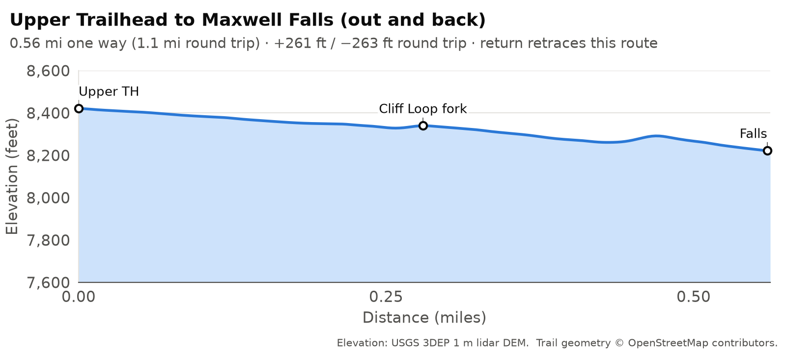
The catch is that the easy part comes first. You lose about 200 ft on the way in and gain it all back walking to the car. Short, yes, but it’s uphill at 8,000-plus feet. Pace yourself and hold back some water and snacks for the return.
Map © OpenStreetMap contributors. Trail signs are few: photograph the trailhead map before you start.
The route, step by step
Unofficial trails and junctions. Besides the official Forest Service trails, the Maxwell Falls area has many other trails, old roads and trail intersections that are not officially mapped or signed. It’s easy to take a wrong turn. Know in advance where you’re going, and store the trails on your phone or GPS device before you leave home so they work without a signal: download our GPX tracks and printable map, or save the area for offline use in the free COTREX app, Colorado’s official state trail map.
Distances are measured along the trail from the upper lot.
The upper lot (0 mi)
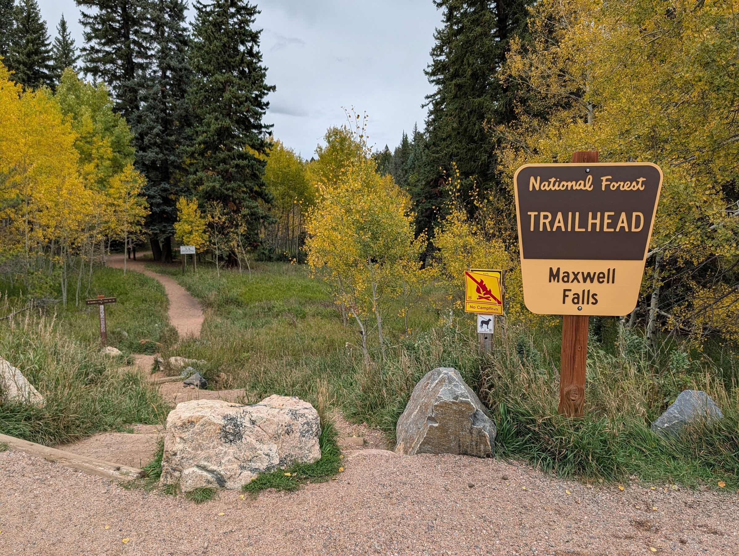
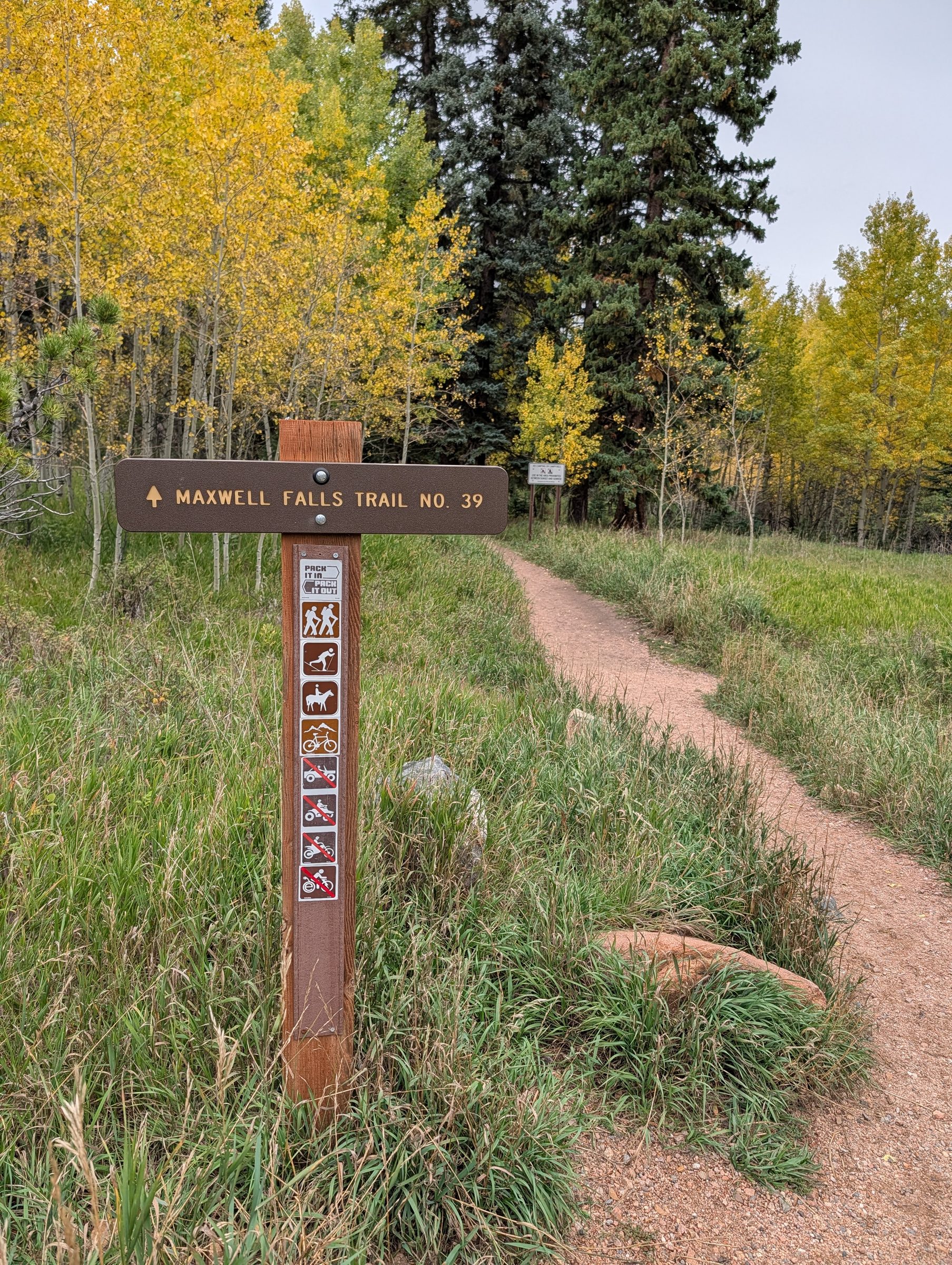
Find the trailhead kiosk at the lot. Take a phone photo of the map sign. Several social trails and old roads branch off nearby, and cell data is hit or miss. The brown post where the trail leaves the lot reads “Maxwell Falls Trail No. 39.”
A short connector path leads from the lot into the trees.
Old-road junction (about 0.18 mi)
The connector meets an old road running through the area. It’s an old four-wheel-drive track, not the trail to the falls. Follow the signed trail toward the falls.
Cliff Loop fork (about 0.28 mi)
The Cliff Loop (#39.1) branches off here, heading left toward the rock outcrops. For the short hike, stay on the main trail toward the falls. If you want to add the loop, the Cliff Loop guide has the details.
Down toward the creek (0.3 to 0.5 mi)
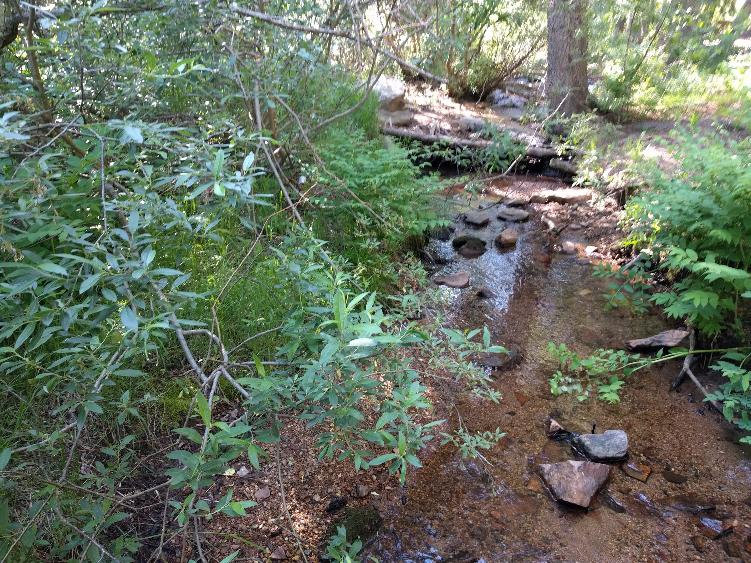
The trail descends steadily through the trees toward Maxwell Creek. Visitors report one or two small creek crossings just before the falls, and in spring runoff or winter those rocks are likely wet or icy.
Maxwell Falls (about 0.56 mi)
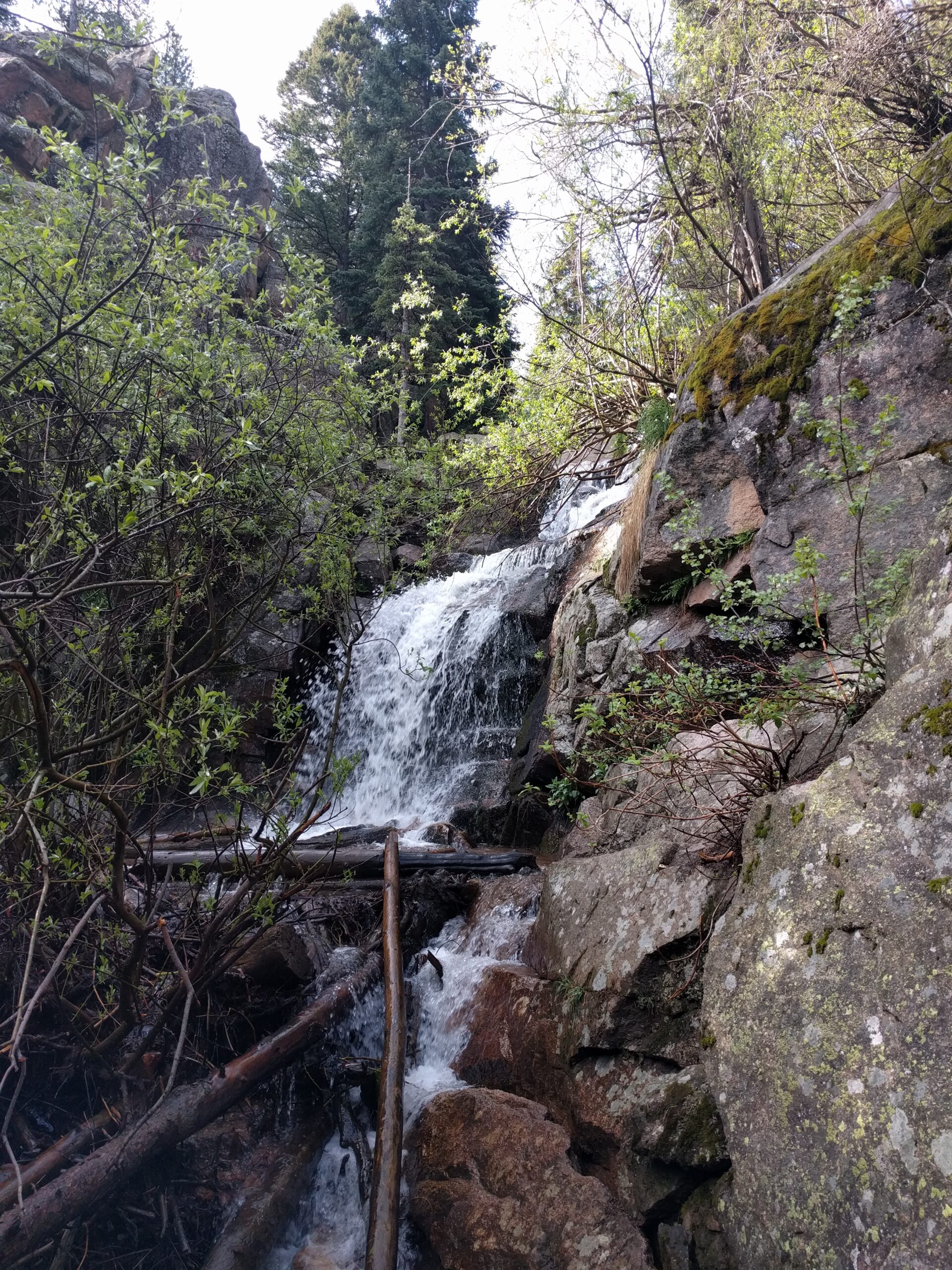
The main trail passes about 40 ft above the pool at the base of the falls, with short side paths down to the water. The falls are a series of tiered cascades over granite ledges; informal estimates put the total drop at roughly 25 ft. How much water you’ll see depends heavily on the season. See Seasons.
The rocks around the falls are steep and slick, and often covered in loose gravel or ice. Look from the bottom, keep kids close, and leave the wet rock faces alone.
Back to the car
Go back the way you came. It’s about 260 ft of climbing over half a mile, which feels like more if you drove up from low elevation this morning. Take it slow.
GPS tracks
Download GPS tracks (GPX) for your phone or GPS unit:
- Upper Trailhead to Maxwell Falls (out and back) (1.12 mi, about 261 ft of climbing)
Route data © OpenStreetMap contributors, ODbL 1.0; elevations USGS 3DEP. License note.
Tips for families
Tell the kids about the uphill before you start. The ones who know “the climb is on the way back” tend to grumble less.
Bring more water than seems necessary; there’s none at the trailhead. And plan a bathroom stop in Evergreen or Conifer, because neither trailhead has restrooms.
The upper lot is small and fills fast on busy summer days, especially weekends and holidays. Go early. The parking page covers the overflow lot and where road parking is legal.
Near the falls, hold small hands. The outcrops look like a playground, and falls on loose rock are one of the most common injuries here.
Wind brought down a lot of trees in the area in 2026. Expect logs across or beside the trail and a few snapped or leaning trunks. Step carefully and don’t rest under leaning trees. Current conditions.
Want more?
The Cliff Loop turns this into about 2.4 miles with around 580 ft of climbing, and adds an overlook. Cliff Loop guide.
With two cars you can hike the whole trail downhill: upper lot to lower lot is about 2.25 miles, mostly descending. Drop a car at the lower trailhead first.
Please don't walk the road between trailheads.
It’s 2.8 miles on Brook Forest Road and the connecting roads, with no sidewalk or shoulder along much of it, 25–30 mph traffic on blind curves, and spotty cell data. Hike out and back, set up a two-car shuttle, or pick a loop that returns to your own car. Why this matters
In winter
The upper route stays popular in winter because it’s short, and the falls often freeze into ice formations. From about December into spring the trail is usually snow-packed or icy, and the downhill stretch on the way in can be slick. Microspikes are strongly recommended. Stay off the frozen creek and the ice at the base of the falls, since creek ice can break underfoot. See winter at Maxwell Falls.
How far is Upper Maxwell Falls from the parking lot?
About 0.56 miles each way, or 1.1 miles round trip, measured along the trail from the upper lot.
Is Upper Maxwell Falls good for kids?
Yes, it's the most family-friendly route. Just remember the 260-ft climb comes on the way back, and keep kids off the rocks at the falls.
Is the upper trail stroller or wheelchair accessible?
No. The trail is dirt with roots, rocks and loose gravel, and there are no accessible facilities.
Where is the Upper Maxwell Falls trailhead?
Off Black Mountain Drive, at about 39.56247, -105.37675. See directions.
Sources
- USFS: Maxwell Falls Upper Trail
- USFS: Upper Maxwell Falls Trailhead
- COTREX: Maxwell Falls Trail
- The Outbound: Hike to Maxwell Falls (visitor reports of creek crossings)
- The Evergreen Experience: Upper Maxwell Falls Hike (2022) (informal height estimate)
- Route measurements: OpenStreetMap contributors and USGS 3DEP 1 m lidar