
Lower Maxwell Falls Trail
Day use only; no camping, fires or shooting. Current conditions
At a glance
| Distance | 1.69 mi one way, about 3.4 mi round trip |
| Climb | About 850 ft round trip |
| Time | 1.5–2 hours, plus time at the falls |
| Difficulty | Moderate |
| Start | Lower trailhead, South Brook Forest Road (about 7,750 ft) |
| High point | About 8,220 ft, at the saddle and again at the falls |
| Dogs | Yes, on a hand-held leash |
| Make it a loop | Add the Cliff Loop for about 4.5 mi total |
Why hike from the lower trailhead
This is the full Maxwell Falls hike, and it feels like a proper walk in the woods. You climb, cross a footbridge, follow a creek and finish at the waterfall. It’s longer and hillier than the upper route, with more going on along the way, and usually a bit more elbow room.
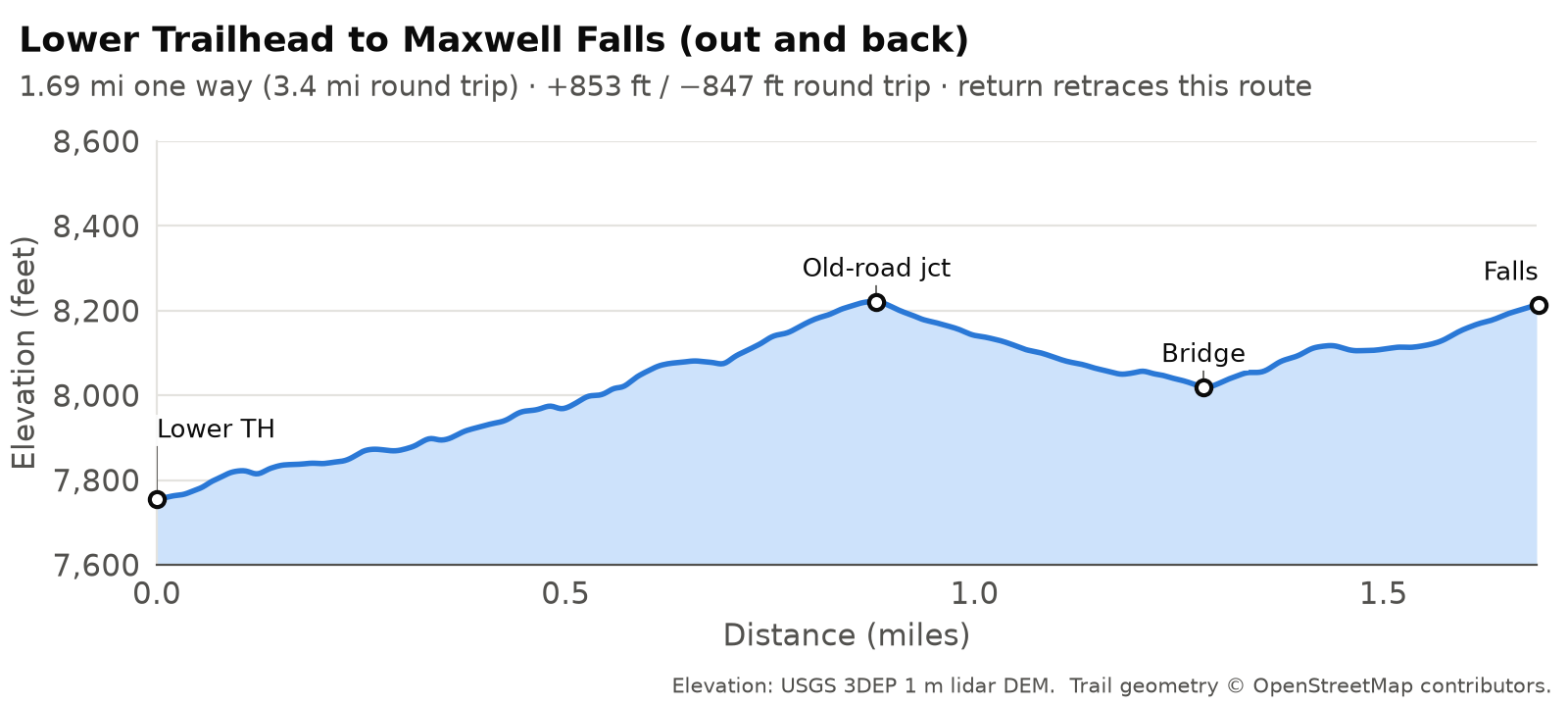
Most descriptions get one thing wrong. It isn’t a steady climb up the creek. The trail first climbs through the forest to a saddle, drops to cross Maxwell Creek on a footbridge, and only then follows the creek up to the falls. That means you climb on the way back too. The falls sit only about 460 ft above the lot, but the out-and-back adds up to about 850 ft of climbing.
Map © OpenStreetMap contributors. Trail signs are few: photograph the trailhead map before you start.
The route, step by step
Unofficial trails and junctions. Besides the official Forest Service trails, the Maxwell Falls area has many other trails, old roads and trail intersections that are not officially mapped or signed. It’s easy to take a wrong turn. Know in advance where you’re going, and store the trails on your phone or GPS device before you leave home so they work without a signal: download our GPX tracks and printable map, or save the area for offline use in the free COTREX app, Colorado’s official state trail map.
Distances run from the start of the trail at the lower lot. Landmark distances come from map geometry, so allow a little slack on the ground.
The lower lot (0 mi, about 7,750 ft)
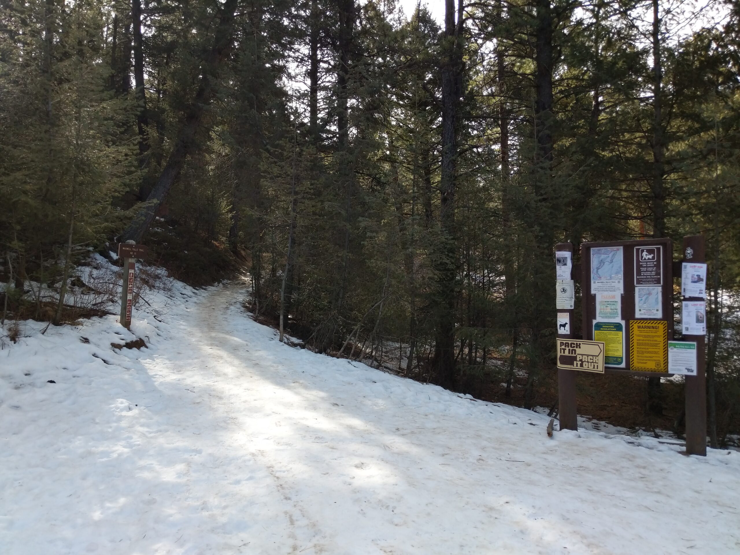
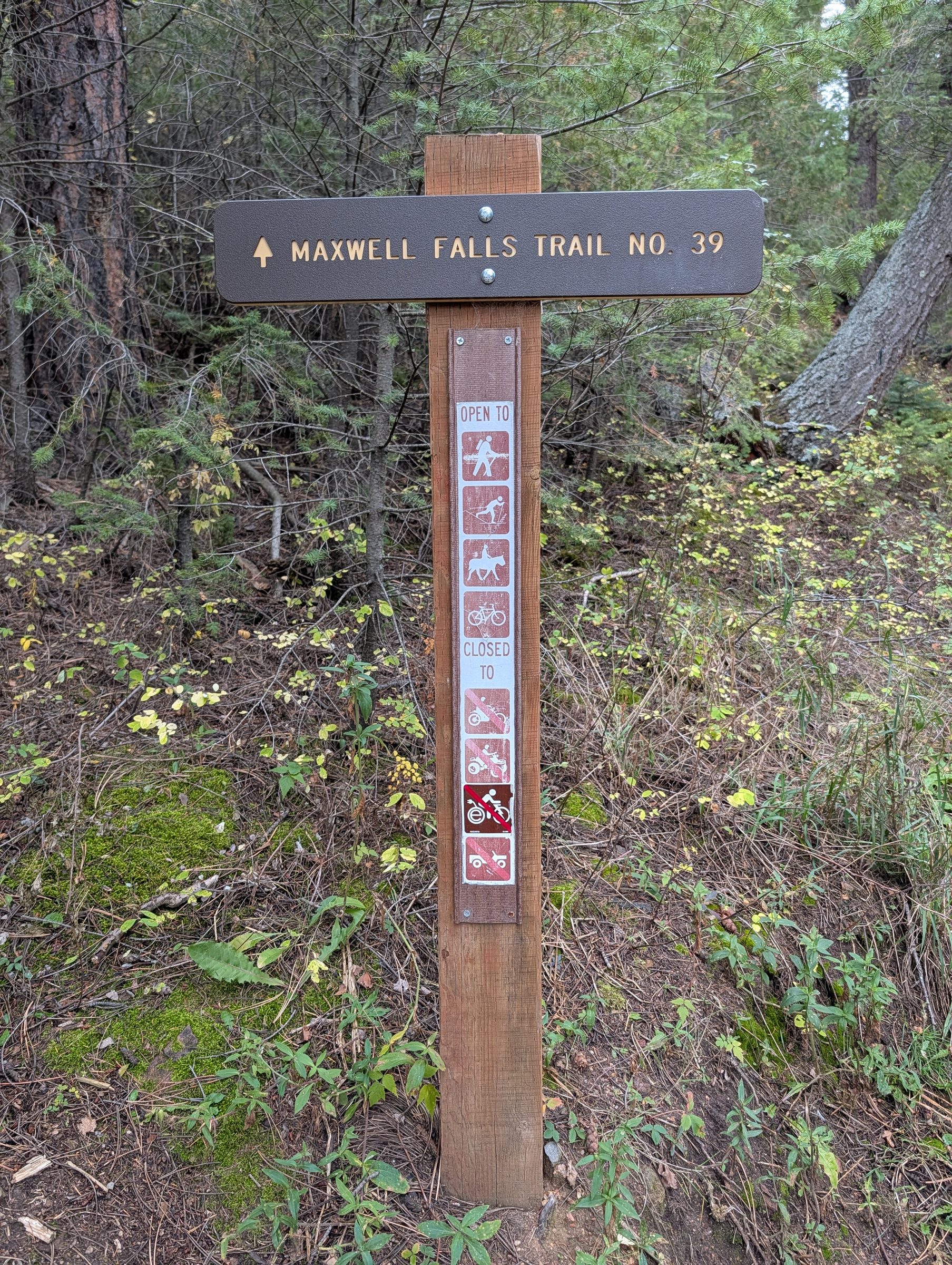
The trail starts at the kiosk by the lot on South Brook Forest Road, at a brown post that reads “Maxwell Falls Trail No. 39.” Take a phone photo of the map sign. Old roads and social trails branch off in several places, and you can’t count on cell signal to sort them out.
The climb to the saddle (0 to 0.9 mi)
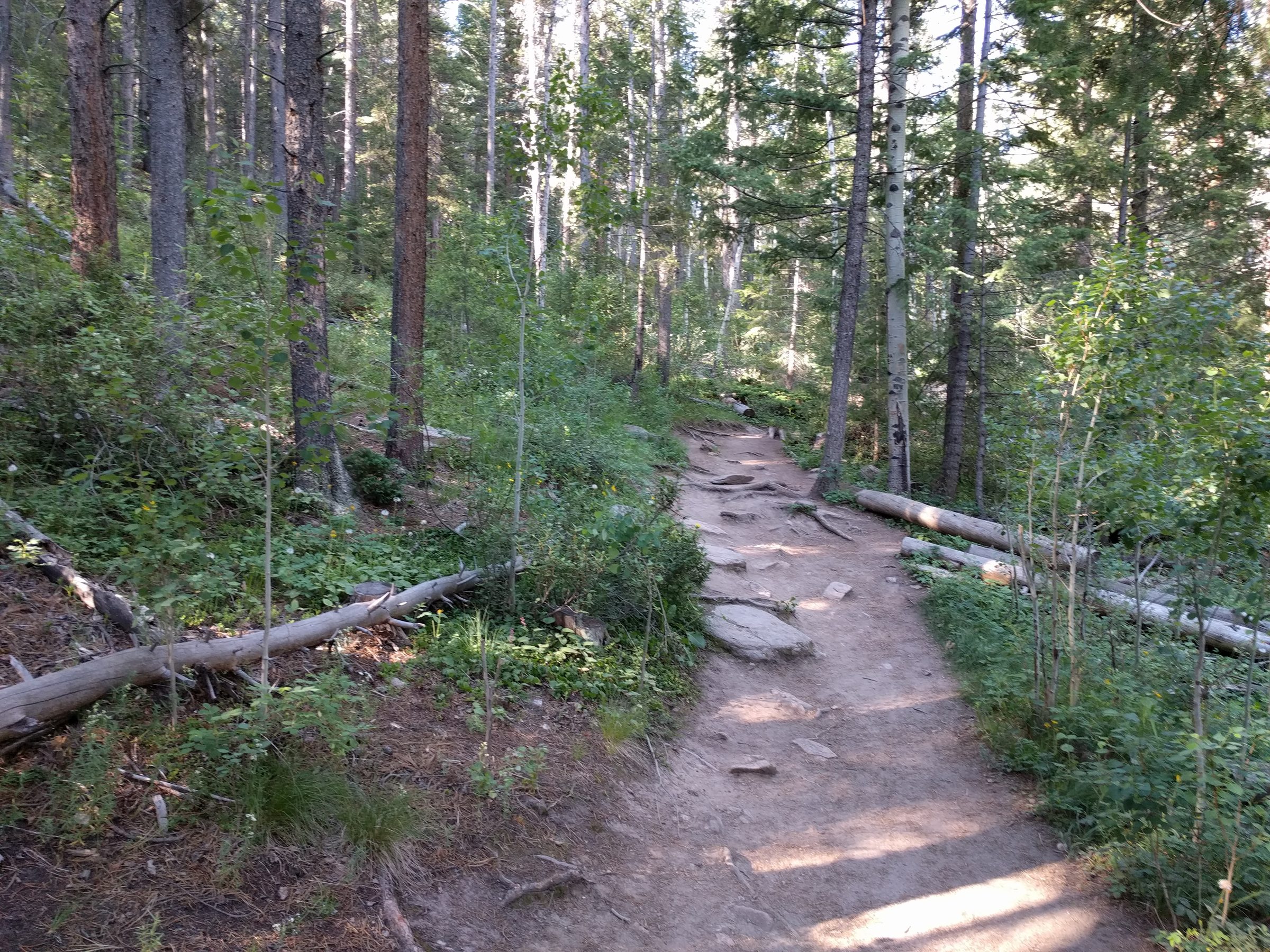
From the lot the trail climbs steadily through lodgepole, ponderosa pine and Douglas-fir, gaining about 460 ft in the first 0.9 mile. It’s the longest sustained climb of the day, with a few short, steep pitches of loose gravel. Take your time. You’re at altitude.
Saddle and old-road junction (about 0.88 mi, about 8,220 ft)
The trail tops out on a forested saddle where an old road crosses. That old four-wheel-drive track heads in roughly the same direction, but it isn’t the trail. Stay on the signed trail, which goes over the saddle and starts down.
Remember this spot for the return. Once you’re back up here, it’s downhill all the way to the car.
Down to the footbridge (0.9 to 1.3 mi)
The trail drops about 200 ft over the next 0.4 mile to Maxwell Creek. Watch your footing on the loose sections.
Footbridge over Maxwell Creek (about 1.28 mi, about 8,020 ft)
A small footbridge crosses Maxwell Creek, and it’s a good place to catch your breath. During spring runoff the creek runs fast and cold, so keep dogs and kids out of the current.
Cliff Loop fork (about 1.32 mi)
The trail forks just past the bridge. Go left to stay on the main trail (#39; older listings say #111) along the creek to the falls. That’s the out-and-back route. The right fork is one end of the Cliff Loop (#39.1), which climbs over the rocky ridge and rejoins the main trail above the falls.
The signs here have been unreliable over the years. If in doubt, the main trail is the one that sticks close to the creek.
Up the creek to the falls (1.3 to 1.7 mi)
The last stretch follows Maxwell Creek upstream, climbing about 200 ft beneath a large cliff face. It’s shady, and you’ll hear the water most of the way.
Maxwell Falls (about 1.69 mi, about 8,180 ft at the pool)
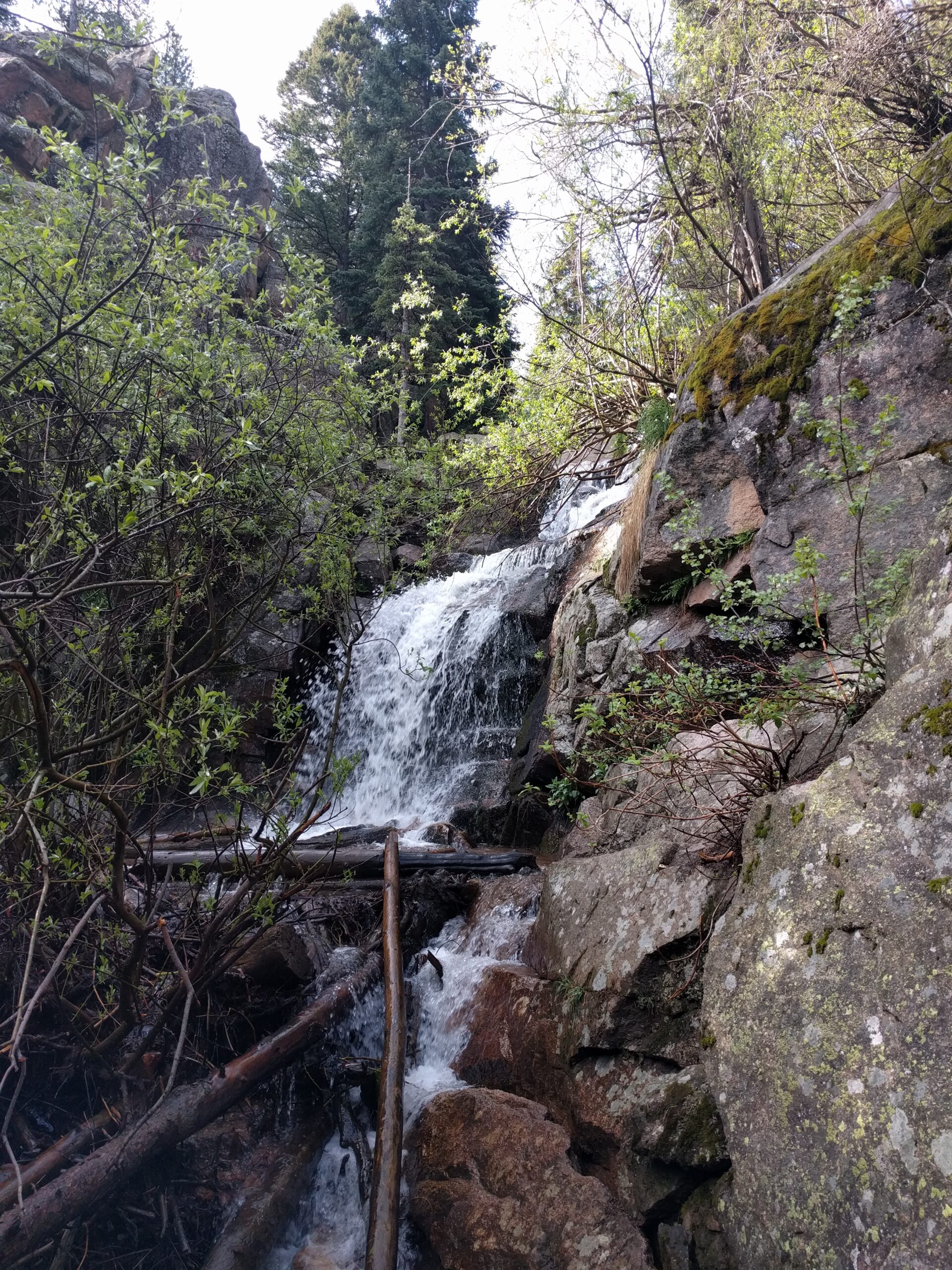
The main trail passes about 40 ft above the pool, and short side paths lead down to the base. The falls are a series of tiered cascades over granite ledges; informal estimates put the total drop at roughly 25 ft. Late spring can be loud and full. By late summer and fall it may be a trickle. See Seasons.
Stay off the steep, wet rock around the falls. Loose rock and slick ledges cause more injuries here than anything else.
Heading back
Return the way you came: down the creek, over the bridge, up about 200 ft to the saddle, then down to the lot. For a change of scenery you can come back over the Cliff Loop instead.
GPS tracks
Download GPS tracks (GPX) for your phone or GPS unit:
- Lower Trailhead to Maxwell Falls (out and back) (3.38 mi, about 853 ft of climbing)
Route data © OpenStreetMap contributors, ODbL 1.0; elevations USGS 3DEP. License note.
Coming back over the cliffs
From the lower trailhead you can turn the hike into a lollipop loop of about 4.5 miles and 1,150 ft of climbing. Hike to the falls, continue a short way up the main trail to the upper Cliff Loop fork (about 0.28 mi before the upper lot), and return over the cliffs to the fork by the footbridge. It also works in reverse, cliffs first.
Direction matters because of one pitch. The steepest bit of the loop, about 28% over 100 ft, is on the cliff side near the footbridge end. Go falls first and you walk down it at the end of the loop. Go cliffs first and you climb up it early, while your legs are fresh, then come home along the creek past the falls. Plenty of hikers would rather climb steep, loose ground than descend it. Details and profiles are in the Cliff Loop guide.
Hiking the whole trail one way
The full trail between trailheads is about 2.25 miles. Going from the lower lot up to the upper lot climbs about 890 ft and descends about 230 ft. Only do it with a car waiting at the other end.
Don't walk back to your car on the road
Hiking the trail from one trailhead to the other and then walking the road back to your car looks easy on a phone. Please don’t do it. We measured the road, and it’s a bad walk.
The two lots are only about 1.6 miles apart as the crow flies, but the road winds. Lot to lot is 2.79 miles on Brook Forest Road and the connecting roads, compared with 2.25 miles on the trail, and walking up from the lower lot the road climbs about 710 ft.
Much of it has no sidewalk or shoulder, so you’d be walking in the traffic lane. Cars take the blind curves at 25–30 mph, and drivers don’t expect people on foot, least of all near dusk. Cell signal comes and goes for many carriers along this stretch, too. Once you’re out there you may not be able to load a map, call for a ride, or even get a 911 call through.
Better ways to do it:
- Out and back. Hike to the falls and return the way you came. Everything is on the trail, and you end at your car.
- Two-car shuttle. Leave one car at each trailhead and hike the full trail one way. The drive between lots is about 2.8 miles (roughly 6 minutes).
- A loop. The Cliff Loop returns to the trailhead you started from: about 2.4 miles from the upper lot, or about 4.5 miles from the lower lot.
Distances measured from OpenStreetMap road and trail geometry with USGS 3DEP lidar elevation. See how we measure.
Phone signal and getting help
Much of the lower trail runs low in the canyon, where cell signal is spotty and a 911 call may not connect. Call 911 first. If that fails, text 911; Jefferson County accepts Text to 911. Say where you are and what’s wrong.
If you still can’t get through, head for higher ground. Locals get the best signal at Meditation Rock, the cliff area above the lower falls trail, which you reach on the Cliff Loop (#39.1) from the fork just past the footbridge. And before you leave home, tell someone your plan and download an offline map (downloads).
More in Safety.
Tips
The lower lot is small and fills fast on busy summer days, so start early. There’s an overflow lot, plus legal road parking where it’s signed and safe. Parking rules.
There’s no water at the trailhead. Bring plenty. Evergreen Fire/Rescue says dehydration, heat exhaustion and altitude sickness are among the most common reasons hikers here need help.
Wear shoes with some grip. The steep bits are mostly loose gravel over hard ground.
You have to be out of the area by sunset, which is easy to forget if you linger at the falls.
From December into spring this route is usually snowy or icy, and microspikes are worth carrying.
Wind brought down a lot of trees in the area in 2026. Expect logs across or beside the trail and a few snapped or leaning trunks. Step carefully and don’t rest under leaning trees. Current conditions.
How long is the Lower Maxwell Falls hike?
About 1.7 miles each way, or 3.4 miles round trip, with about 850 ft of total climbing. Most people take 1.5 to 2 hours.
Is the lower trail harder than the upper trail?
Yes. It's three times as long and climbs more than three times as much, with a climb to a saddle on the way in and again on the way back.
Which way do I go after the bridge?
Go left to stay on the main trail along the creek to the falls. The right fork is the Cliff Loop.
Where is the lower trailhead?
On South Brook Forest Road, about 3.6 miles from Highway 73, at about 39.58252, -105.36085. See directions.
Is there cell service on the lower trail?
It's spotty, and even 911 may not connect by the creek. Text 911 if a call fails, or climb to Meditation Rock on the Cliff Loop, where locals find the best signal.
Sources
- USFS: Maxwell Falls Lower Trail
- USFS: Lower Maxwell Falls Trailhead
- COTREX: Maxwell Falls Trail
- Hiking Project: Maxwell Falls Trail
- 5280: Hiking Maxwell Falls (2012)
- Day Hikes Near Denver: Maxwell Falls
- City of Arvada: Text to 911 in Jefferson County
- Route measurements: OpenStreetMap contributors and USGS 3DEP 1 m lidar