
Maxwell Falls trailheads and parking
Open.
Day use only. No entry between sunset and sunrise. No camping, no campfires.
Fire: Stage 1 fire restrictions in effect through December 31, 2026. No charcoal grills; gas or liquid-fuel stoves are OK.
Shooting: Recreational shooting is prohibited under Forest Service Order 02-10-00-25-02, in effect until rescinded.
Rules last checked September 2026. Current conditions
Two trailheads, one trail
Maxwell Falls has two trailheads, both off the county road that winds south from Evergreen. One trail connects them, and the falls sit much closer to the upper end.
- Lower trailhead, on South Brook Forest Road: the longer hike, about 1.7 miles each way to the falls.
- Upper trailhead, off Black Mountain Drive: the short walk, about 0.6 miles each way to the falls.
Both lots are small and free. Neither has restrooms or water, and there is no trash service at any trailhead. You can’t reserve a space, and you don’t need a parking permit or pass.
Map © OpenStreetMap contributors. Trail signs are few: photograph the trailhead map before you start.
Lower Maxwell Falls Trailhead
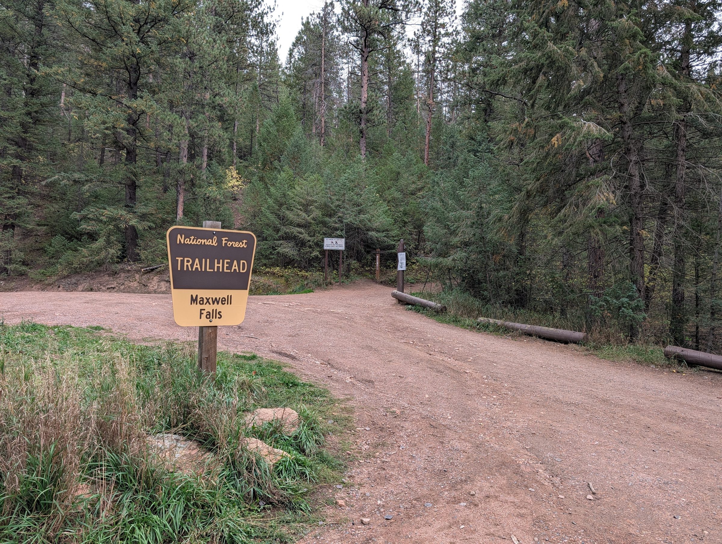
| GPS coordinates | 39.58252, -105.36085 |
| Address used by mapping apps | 7627 S Brook Forest Rd, Evergreen, CO 80439 |
| Elevation | About 7,750 ft |
| Main lot | Free, holds fewer than 18 vehicles. Fills fast on busy summer days |
| Overflow lot | Holds about 15 to 20 vehicles. A semi-official, maintained gravel lot right beside the road at 39.58212, -105.36170, a short walk from the main lot |
| Facilities | None: no restrooms, water or trash service |
| Distance to the falls | 1.7 mi one way, 3.4 mi round trip |
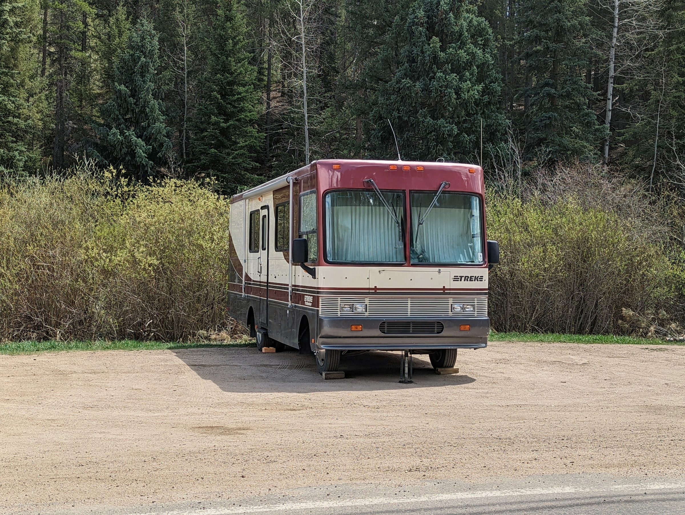
The overflow lot is for day parking only. Sleeping there overnight, in an RV, a van or a car, is illegal under the Forest Service day-use order. Rules.
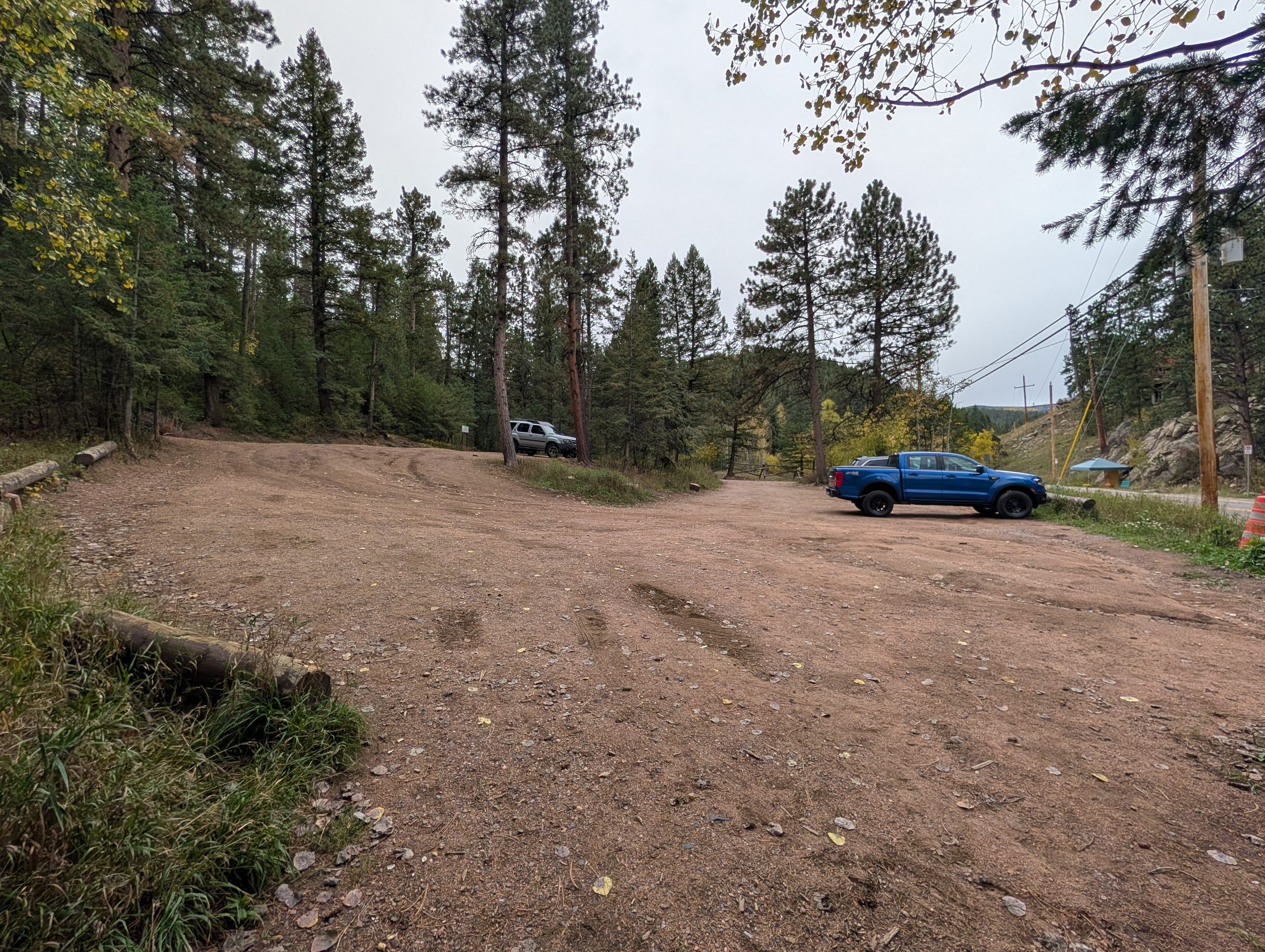
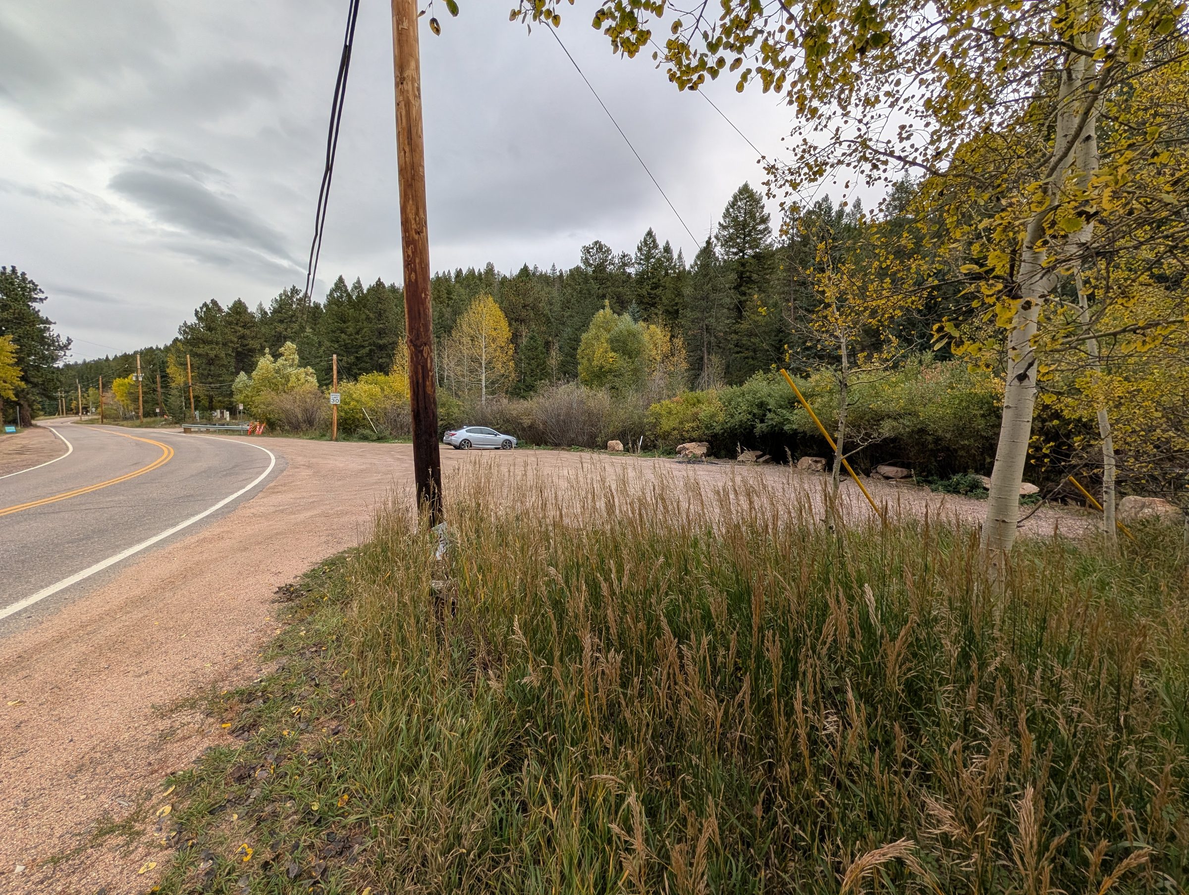
Getting there from Denver (about 45–50 minutes): take I-70 west to exit 252, Evergreen Parkway (CO-74), and follow it into downtown Evergreen. At the junction with Highway 73, go south on 73 for about a mile, then turn right onto South Brook Forest Road. The lower lot is about 3.6 miles up Brook Forest Road. The Forest Service page says “three miles”; we measured 3.6 along the road.
From downtown Evergreen: about 4.5 miles in all, via Highway 73 south and Brook Forest Road.
Navigate by the coordinates above if you can. Street addresses along this road don’t always put you in the lot.
Please don't walk the road between trailheads.
It’s 2.8 miles on Brook Forest Road and the connecting roads, with no sidewalk or shoulder along much of it, 25–30 mph traffic on blind curves, and spotty cell data. Hike out and back, set up a two-car shuttle, or pick a loop that returns to your own car. Why this matters
Upper Maxwell Falls Trailhead
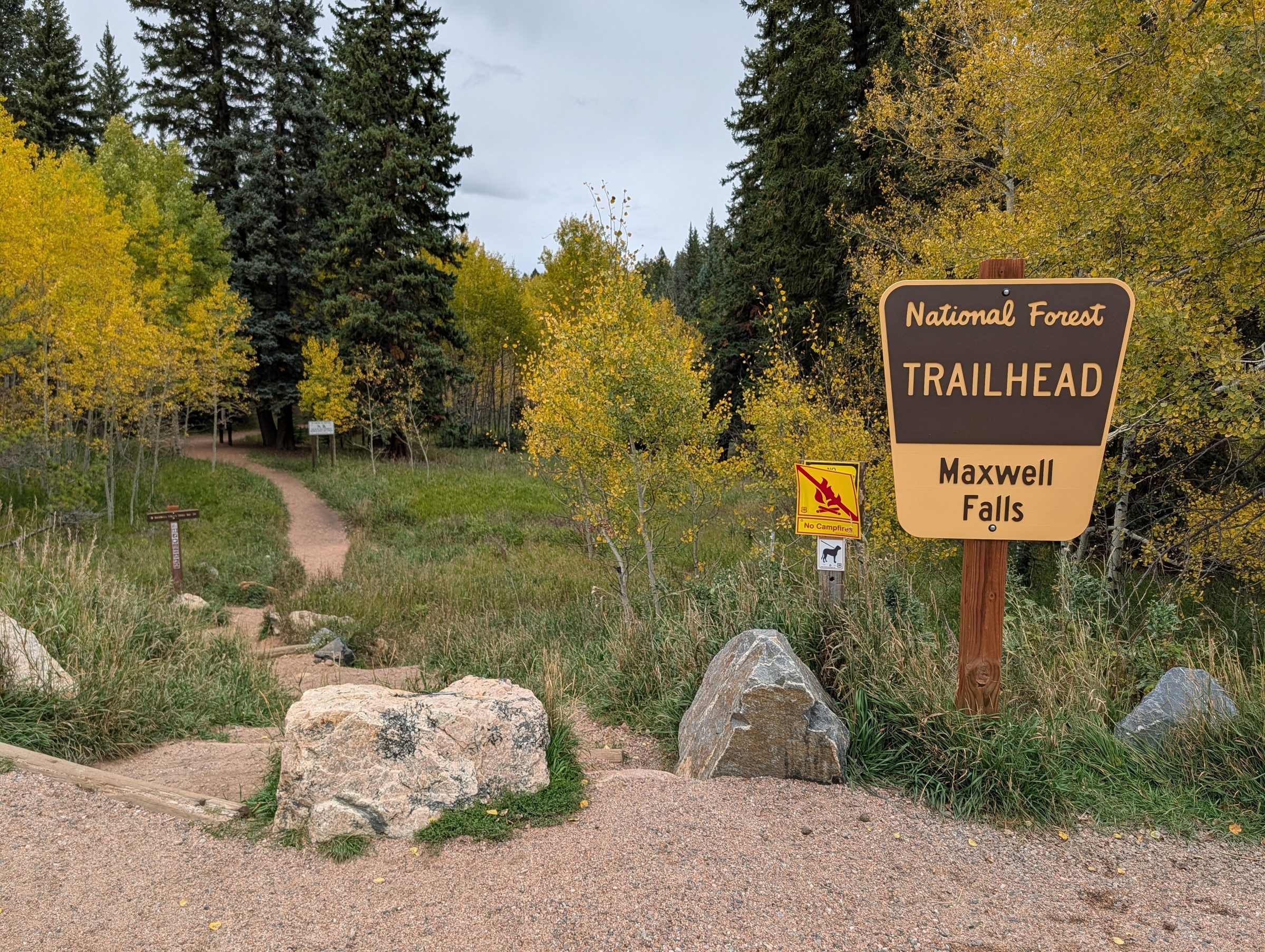
| GPS coordinates | 39.56247, -105.37675 |
| Address used by some apps | 8399 Black Mountain Dr, Conifer, CO 80433 |
| Elevation | About 8,420 ft |
| Lot | Free, unpaved, holds about 15 vehicles. Fills fast on busy summer days |
| Road parking | A little, along Black Mountain Drive within about a third of a mile downhill of the lot |
| Facilities | None: no restrooms, water or trash service |
| Distance to the falls | 0.6 mi one way, 1.1 mi round trip |
Getting there: follow the directions to the lower trailhead and keep going on South Brook Forest Road for another 1.6 miles, past the historic Brook Forest Inn (closed now, and private), to Black Mountain Drive. Turn left and drive 1.2 miles to the lot. Lower lot to upper lot is about 2.8 miles by car, roughly 6 minutes.
You’ll see two different figures for this drive elsewhere, “another 1.6 miles” and “another mile and a quarter.” Both are right; they just measure different pieces. The 1.6 is Brook Forest Road to the turn, and the 1.2 to 1.25 is Black Mountain Drive to the lot.
The upper lot has a Conifer mailing address even though everyone calls it Evergreen, so your phone may show either town.
Parking
Maxwell Falls is popular and both lots are small. On summer and fall weekends they can be full before 8 a.m., and visitors say the worst of it runs from about 10 a.m. to 4 p.m. on nice days. Holidays are the same story.
We counted the spaces ourselves:
| Lot | Holds about |
|---|---|
| Lower trailhead, main lot | Fewer than 18 vehicles |
| Lower trailhead, overflow lot beside the road | 15 to 20 vehicles |
| Upper trailhead | 15 vehicles, plus a little roadside parking on Black Mountain Drive within about a third of a mile downhill |
That’s roughly 50 cars in all on a trail that sees far more than that on a nice Saturday, which is why the road shoulders fill up.
How to park legally:
- In the lots: use marked or obvious spaces. The Forest Service order for this area prohibits parking “in violation of posted instructions,” and vehicles can’t be left in or near the lots between sunset and sunrise.
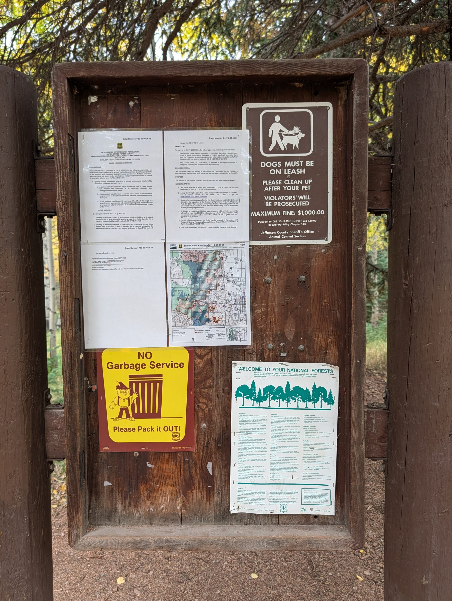
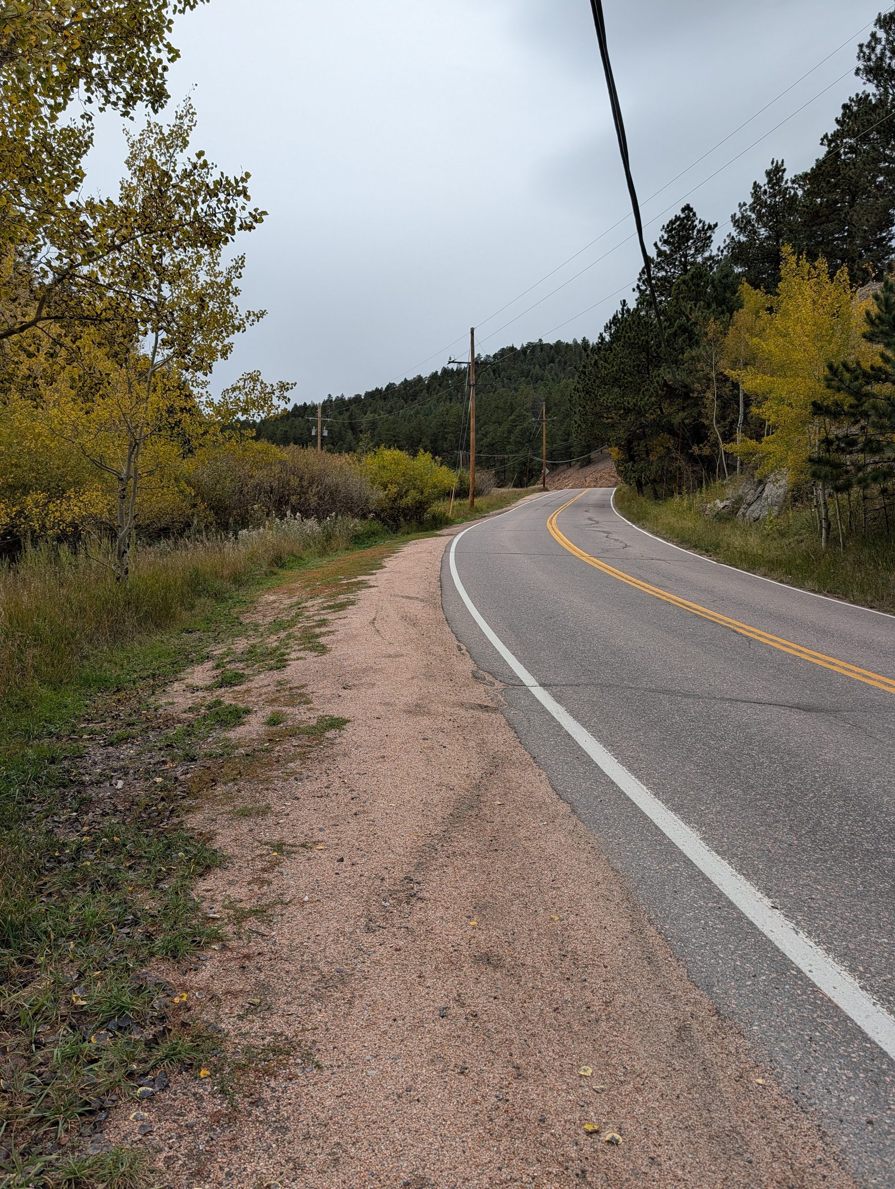
- Along Brook Forest Road: street-side parking is allowed where it’s sensible, safe and not specifically prohibited. “No Parking” signs mark the stretches where the shoulder is too narrow.
- Along Black Mountain Drive: the few roadside spots below the upper lot follow the same rules. Pull completely off the pavement and keep clear of driveways.
- Off the pavement: both tires on the road side must be completely off the road, past the white painted edge line. Colorado law (C.R.S. 42-4-1202) prohibits parking on “the paved or improved and main-traveled part of the highway,” and the “roadway” doesn’t include the shoulder (C.R.S. 42-1-102).
- County distances: Jefferson County bars parking that blocks a travel lane, or within 5 feet of a driveway, 15 feet of a fire hydrant, or 30 feet of a stop or yield sign.
The Sheriff’s Office enforces all of this, and it does write tickets on busy, contentious days (visitors report tickets). The Brook Forest Inn is closed and private, and its lot is not trail parking. And please don’t sit idling in the road waiting for someone to leave. On a narrow mountain road that backs everyone up fast.
Brook Forest Road is the only way in and out for hundreds of homes. A bumper sticking into the lane is enough to hold up a fire engine or an ambulance, which is why the neighbors care as much as they do.
To report a parking problem, call Jefferson County dispatch (non-emergency) at 303-980-7300.
If the lot is full
Both trailheads have small, free lots that fill fast on busy summer days, especially weekends and holidays. The lower main lot holds fewer than 18 vehicles and its overflow lot beside the road about 15 to 20. The upper lot holds about 15, with a little roadside parking on Black Mountain Drive below it. If there’s no space:
- Park on the road only where it’s legal and safe. Parking along Brook Forest Road is allowed where it’s sensible, safe and not signed “No Parking.” Those signs mark the stretches where the shoulder is too narrow. Both tires on the road side must be completely off the road, past the white painted edge line: Colorado law bars parking on the main-traveled part of a highway, and the “roadway” doesn’t include the shoulder. Never block a travel lane or a driveway (Jefferson County parking rules).
- Expect tickets on busy days. The Jefferson County Sheriff’s Office enforces parking here, and neighbors see cars ticketed most crowded weekends.
- Try the other trailhead, about 2.8 miles away by car. See Trailheads and parking.
- Come back before 8 a.m. or on a weekday. Either one makes a big difference.
- Hike somewhere else. Evergreen has good alternatives, and Jefferson County Open Space posts live parking levels for its parks. See Hikes near Evergreen.
Best times to go
Weekdays are easiest by far. On weekends, get there before 8 a.m. if you want a space; the trail is cooler and quieter then too. Late afternoon can work, but you have to be out by sunset. Winter weekdays are often close to empty, and the frozen falls are worth the trip if you bring traction. See Seasons.
Before you leave home
Carpool if you can. Every car you leave at home is one more space for somebody else.
Decide on a trailhead ahead of time. If the upper lot is full, the lower trailhead is 2.8 miles back down the road (and a longer hike). If both are full and there’s no legal road space, we keep a list of hikes near Evergreen as backups.
Cell coverage in the canyon is unreliable, so download a map first. Our trail map page has printable and GPX versions. And tell someone which trailhead you’re using and when you expect to be back.
Hiking the whole trail
The full trail between the trailheads is about 2.25 miles one way. To hike it end to end, leave a car at each lot first. Starting at the upper lot and ending at the lower one is mostly downhill (about 240 ft up and 900 ft down).
Don't walk back to your car on the road
Hiking the trail from one trailhead to the other and then walking the road back to your car looks easy on a phone. Please don’t do it. We measured the road, and it’s a bad walk.
The two lots are only about 1.6 miles apart as the crow flies, but the road winds. Lot to lot is 2.79 miles on Brook Forest Road and the connecting roads, compared with 2.25 miles on the trail, and walking up from the lower lot the road climbs about 710 ft.
Much of it has no sidewalk or shoulder, so you’d be walking in the traffic lane. Cars take the blind curves at 25–30 mph, and drivers don’t expect people on foot, least of all near dusk. Cell signal comes and goes for many carriers along this stretch, too. Once you’re out there you may not be able to load a map, call for a ride, or even get a 911 call through.
Better ways to do it:
- Out and back. Hike to the falls and return the way you came. Everything is on the trail, and you end at your car.
- Two-car shuttle. Leave one car at each trailhead and hike the full trail one way. The drive between lots is about 2.8 miles (roughly 6 minutes).
- A loop. The Cliff Loop returns to the trailhead you started from: about 2.4 miles from the upper lot, or about 4.5 miles from the lower lot.
Distances measured from OpenStreetMap road and trail geometry with USGS 3DEP lidar elevation. See how we measure.
At the trailhead
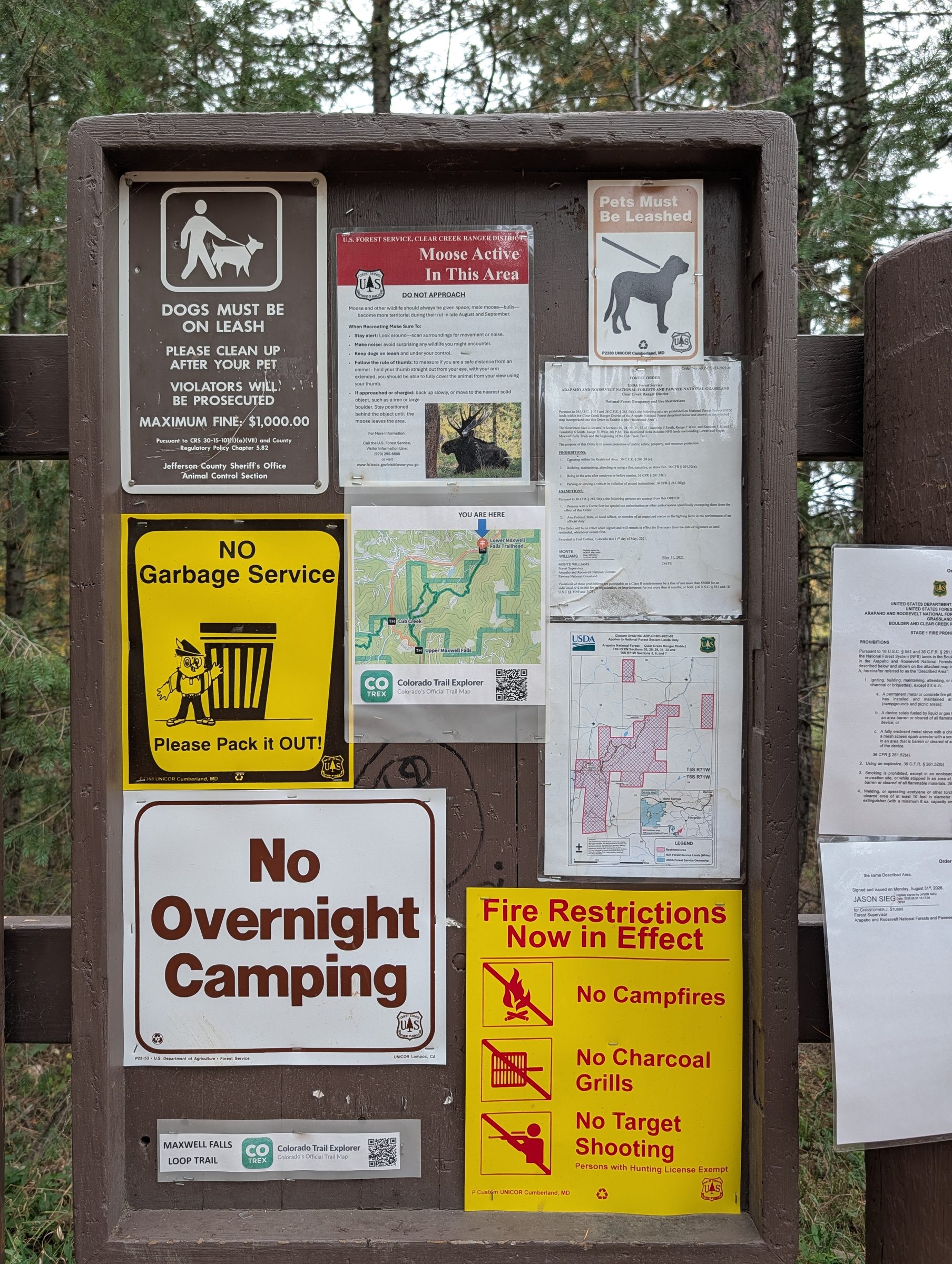
There are no restrooms, so stop in Evergreen or Conifer on the way up; lots of visitors come in from Conifer and US 285. There’s no water either; bring enough for everyone, dogs included. There’s no trash service at any trailhead; signs at the lower, upper and Cub Creek trailheads read “No garbage service. Please pack it out!” Everything goes home with you, every dog-waste bag included. Bags left at the trailhead or along the trail are a sore point with the neighbors.
The kiosks also post the day-use order, the fire restrictions, the Jefferson County leash law (fines up to $1,000), a Forest Service moose notice and a COTREX “You are here” map. Rules has the details.
Don’t count on your phone. Signal is spotty at both lots and in the canyon, and even 911 may not connect. If a call fails, text 911 (Jefferson County accepts texts) or move to higher ground. Locals get the best signal at Meditation Rock on the Cliff Loop. More in Safety.
Recreational shooting is prohibited here under a Forest Service order.
Snap a photo of the map sign at the kiosk before you start. Several unsigned social trails and old roads branch off the main trail. The QR code on the kiosk’s COTREX map links to the free COTREX app, Colorado’s official state trail map; download it and save the area for offline use at home, where you have signal. Also check the time: sunset comes early in the canyon, and the lots close to vehicles overnight.
Where do I park for Maxwell Falls?
In one of the two small, free lots (the lower trailhead on South Brook Forest Road, which also has an overflow lot, or the upper trailhead off Black Mountain Drive), or on Brook Forest Road where it's safe, legal and not signed "No Parking," with both road-side tires past the white edge line.
How many cars fit in the lots?
By our count, the lower main lot holds fewer than 18 vehicles and the lower overflow lot about 15 to 20. The upper lot holds about 15, with a little roadside parking on Black Mountain Drive below it.
Is there a fee or parking permit?
No. Parking is free and no permit, pass or reservation is required. The trailheads are not reservable.
What if the lot is full?
Try the lower overflow lot or the other trailhead, park legally on the road where it's allowed, come back earlier or on a weekday, or pick another hike near Evergreen. The Sheriff does ticket on busy days.
How far apart are the trailheads?
About 2.8 miles by road and 2.25 miles by trail. Don't walk the road between them; see the road warning.
Are there restrooms at the trailhead?
No. Neither trailhead has restrooms or water, and there's no trash service at any trailhead. Pack out everything, including dog bags.
Is there cell service at the trailheads?
It's spotty, and even 911 may not connect. Text 911 if a call fails, move to higher ground such as Meditation Rock on the Cliff Loop, and carry an offline map.
Sources
- USFS: Lower Maxwell Falls Trailhead
- USFS: Upper Maxwell Falls Trailhead
- USFS: Maxwell Falls and Cub Creek Occupancy and Use Restrictions
- COTREX: Lower Maxwell Falls trailhead and Upper Maxwell Falls trailhead
- Jefferson County: Parking
- C.R.S. 42-4-1202: Parking or abandonment of vehicles and C.R.S. 42-1-102: Definitions (“roadway”)
- TripAdvisor: Maxwell Falls visitor reviews (parking tickets)
- The Virtual Sherpa: Maxwell Falls hike guide (2017) (overflow lot)
- COTREX, the Colorado Trail Explorer (official state trail map and app)
- Lot capacities counted on site, and kiosk signs photographed, September 28, 2026
- City of Arvada: Text to 911 in Jefferson County
- USFS: Permanent Recreational Shooting Order 02-10-00-25-02
- Recreation.gov: Upper and Lower trailhead listings
- 5280: Hiking Maxwell Falls (2012)
- Road distances measured from OpenStreetMap road geometry