
Hiking safety and Leave No Trace at Maxwell Falls
Day use only; no camping, fires or shooting. Current conditions
In an emergency, call 911
- Emergency: call 911. Tell the dispatcher you’re on the Maxwell Falls Trail near Evergreen, which trailhead you started from, and roughly how far you’ve hiked.
- Non-emergency (Jefferson County dispatch): 303-980-7300.
- If you can, share your coordinates. Most phones show them in the compass or map app, even without data.
Even 911 may not connect here
Cell signal is spotty in the canyon, and in some spots even a 911 call won’t go through. Sort out what you’d do before you need to.
If a call fails, text 911. Jefferson County dispatch accepts Text to 911 from most carriers, and the rule is “call if you can, text if you must.” Put your location and what’s wrong in the first message, since the dispatcher won’t know where you are. If texting doesn’t work where you’re standing, you’ll get a bounce-back message.
Signal is usually better up high than down by the creek. Locals get the best signal at Meditation Rock, the cliff area above the lower falls trail, which you reach on the Cliff Loop (#39.1). Only go up there if you can do it safely. If someone is hurt, send the fastest able person and have someone stay with the injured hiker.
Before you leave home, tell someone which trailhead you’re using, your route and when you’ll be back. The Alpine Rescue Team points out that once a responsible person knows your plan, “a search will begin in short order” if you don’t return.
Download our map and GPX files too, so you can find your way and read your coordinates with no signal. Alpine Rescue is blunt about this: “Cell phone or GPS is not a substitute for preparation.”
If you’re lost, stop and stay put instead of wandering. Alpine Rescue teaches S.T.O.P.: Sit, Think, Observe, Plan.
Rescues here are handled by Jefferson County with local fire departments, including Evergreen Fire/Rescue, and the volunteer Alpine Rescue Team, which has been doing mountain search and rescue out of Evergreen since 1959.
It's a short hike, but it's a mountain hike
Maxwell Falls isn’t a big hike, which is exactly why people get caught out. Forgetting something can make for an unpleasant afternoon, or a dangerous one. Evergreen Fire/Rescue has asked newer and out-of-town hikers to think about their fitness, wear shoes that grip on loose gravel, and carry water. Most of the trouble here is ordinary stuff: dehydration, heat exhaustion and altitude sickness.
What to bring, even on the short walk
- Water, and then some extra water (for your dog, too)
- A snack, and a little extra food
- A rain jacket and a warm layer
- A basic first aid kit
- A downloaded or printed map (get one here)
- A charged phone
- Sunscreen and a hat
- In winter and spring: microspikes
Know your limits
The trail runs between about 7,750 and 8,420 ft. If you just got here from lower elevation, or you have asthma, diabetes, a heart condition, bad knees or back, or any other health issue, take it easy. Altitude, steep climbing and dehydration make any medical problem worse. Headache, nausea and unusual tiredness can be early signs of altitude sickness. Rest, drink water, and head down.
Tell someone your plan
Even in a group, let someone at home know where you’re going and when you’ll be back. If something goes wrong, rescuers will know where to look.
Hike with a partner
Two people are much less likely to panic. One can help the other up a loose, steep bit, or go for help if needed.
Cell coverage
Don’t count on your phone. For many carriers, data is spotty in the canyon and along the roads, and a 911 call may not connect from the canyon floor. Download your map at home and pick a meeting point in case your group gets split up. The best signal, again, is at Meditation Rock on the Cliff Loop. See Even 911 may not connect here above.
Know the hazards
Steep rock and loose ground
Around the falls and the Cliff Loop outcrops you’ll find steep rock faces, loose rock and loose soil. People love to scramble on the rocks near the falls, kids most of all, and a slip on loose or wet rock is the most likely way to get hurt here. Look at the falls from the bottom, stay back from the edges on the Cliff Loop, and don’t climb the wet rock faces.
Ice and snow
From about December into spring, expect packed snow and ice on the trail, especially on the steep sections and near the falls. Microspikes make a huge difference. Never walk on the frozen creek or the ice at the base of the falls, because creek ice can break underfoot. More in winter at Maxwell Falls.
Downed and leaning trees
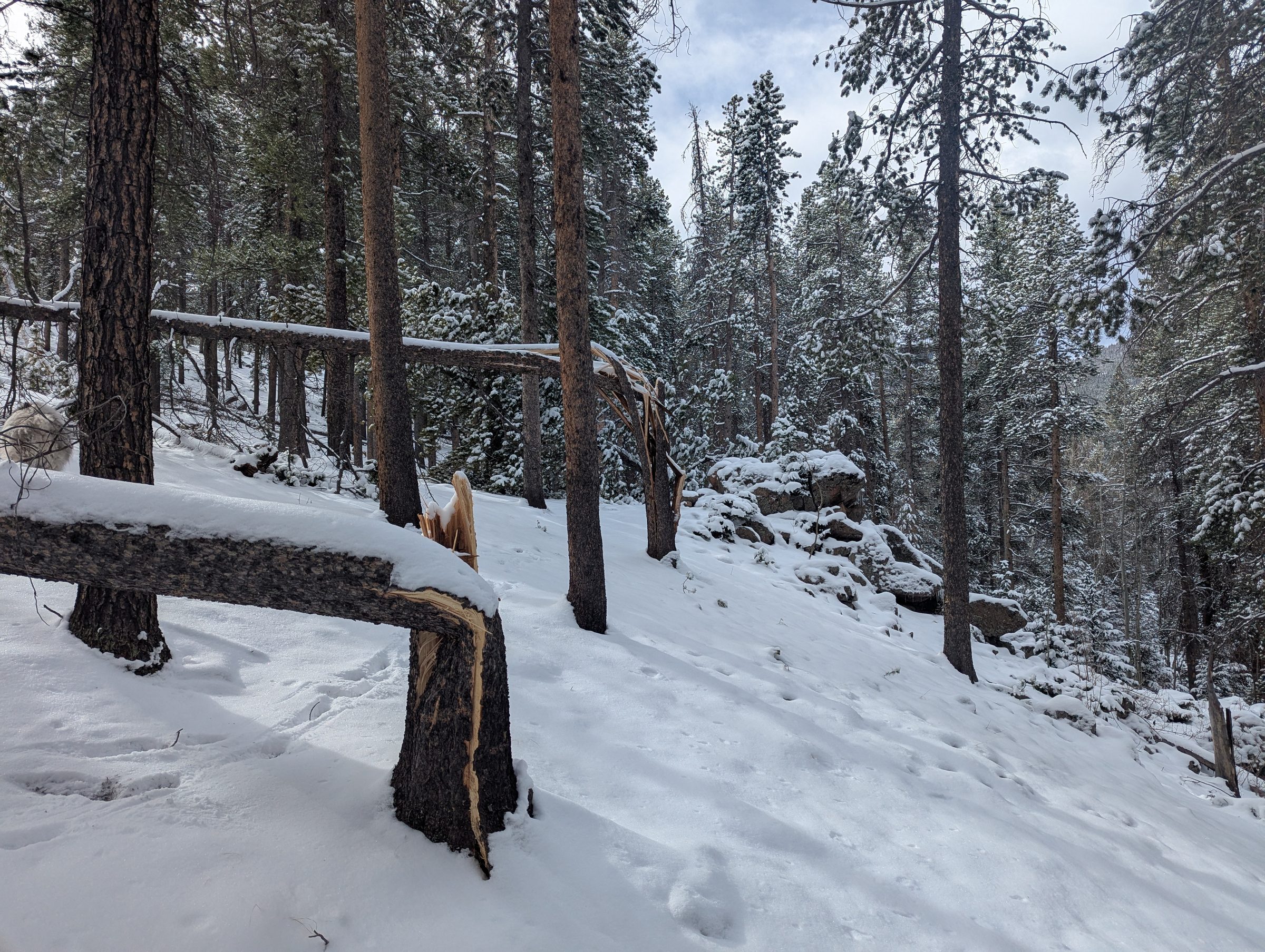
As of September 2026, no significant downed trees are blocking the trails, but that can change with the next storm. Wind brought down trees around the area earlier in 2026 (the photo is from March), and snapped or leaning trunks can still fall, especially in wind. Step over logs carefully, since they roll and get slick when wet or icy. Don’t climb on piles of downed timber, and don’t take your break under a leaning tree or a hanging limb. If a tree blocks the trail, go around on the shortest safe line and get back on the trail right away instead of starting a new path. Please tell us where you found it.
Water
In late spring the creek runs fast and very cold with snowmelt. Keep kids and dogs out of the current, especially near the footbridge and the falls. Don’t drink creek water without treating it.
Lightning and weather
Afternoon thunderstorms are routine in the Colorado mountains in summer. Start early, watch the sky, and head down if you hear thunder, particularly if you’re up on the exposed Cliff Loop outcrops. The weather turns quickly in any season, so bring layers for wind, rain, hail or snow.
Heat and dehydration
The sunny stretches get warm on summer days, and the air at altitude is dry. Drink before you’re thirsty, and turn back early if anyone in your group feels unwell.
Shooting
Recreational shooting is prohibited around Maxwell Falls under a permanent Forest Service order, but licensed hunters are exempt, so during fall hunting seasons you may hear or meet hunters. Stay on the trail and wear a bright layer. If you hear shooting close by, move away from it and report it. More in Rules.
Getting lost
Besides the official Forest Service trails, the Maxwell Falls area has plenty of other trails, old roads and junctions that aren’t officially mapped or signed, and a wrong turn is easy. Know where you’re going ahead of time, and save the trails to your phone or GPS before you leave home so they work without a signal. You can download our GPX tracks and printable map, or install the free COTREX app, Colorado’s official state trail map, and save the area for offline use.
The main trail is easy to follow. The side branches are the problem, especially on the Cliff Loop and near the saddle on the lower route. Snap a photo of the map sign at the trailhead, carry a downloaded map, and stay on the signed trail. When in doubt, go back the way you came.
Don't walk the road between trailheads
Don't walk back to your car on the road
Hiking the trail from one trailhead to the other and then walking the road back to your car looks easy on a phone. Please don’t do it. We measured the road, and it’s a bad walk.
The two lots are only about 1.6 miles apart as the crow flies, but the road winds. Lot to lot is 2.79 miles on Brook Forest Road and the connecting roads, compared with 2.25 miles on the trail, and walking up from the lower lot the road climbs about 710 ft.
Much of it has no sidewalk or shoulder, so you’d be walking in the traffic lane. Cars take the blind curves at 25–30 mph, and drivers don’t expect people on foot, least of all near dusk. Cell signal comes and goes for many carriers along this stretch, too. Once you’re out there you may not be able to load a map, call for a ride, or even get a 911 call through.
Better ways to do it:
- Out and back. Hike to the falls and return the way you came. Everything is on the trail, and you end at your car.
- Two-car shuttle. Leave one car at each trailhead and hike the full trail one way. The drive between lots is about 2.8 miles (roughly 6 minutes).
- A loop. The Cliff Loop returns to the trailhead you started from: about 2.4 miles from the upper lot, or about 4.5 miles from the lower lot.
Distances measured from OpenStreetMap road and trail geometry with USGS 3DEP lidar elevation. See how we measure.
Wildlife
This is their home. Mule deer are common, along with squirrels, chipmunks and lots of birds. Elk live around Evergreen, so watch for them on the drive. Black bears, mountain lions and moose all live in these foothills too.
Watch from a distance, and never approach, follow or feed an animal. Feeding hurts their health and changes how they behave, which usually ends badly for the animal. A hand-held leash on your dog protects both the dog and the wildlife. Give animals extra room in spring, when they have young, and in winter, when they’re saving every bit of energy.
Bears
Bears are busiest from late summer into fall. That’s when they go into what Colorado Parks and Wildlife calls hyperphagia, compulsive overeating before hibernation: feeding up to 22 hours a day to take in about 20,000 calories a day. Most Colorado bears are active from mid-March through early November.
Keep food packed away and carry out every scrap and wrapper. If you see a bear, CPW’s advice is to “stand still, stay calm and wait for the bear to leave.” Make sure it has a way out, and never run or climb a tree.
Mountain lions
Mountain lions live in these ponderosa foothills wherever there are deer. Neighbors have found lion kills in the more off-trail parts of this area, which is one more reason to stay on the signed trail.
CPW recommends hiking in groups and making some noise. Keep kids close and dogs leashed. If you do meet a lion, don’t run. Speak calmly and firmly, move slowly, make yourself look bigger by raising your arms or opening your jacket, and pick up small children. If it acts aggressively, fight back.
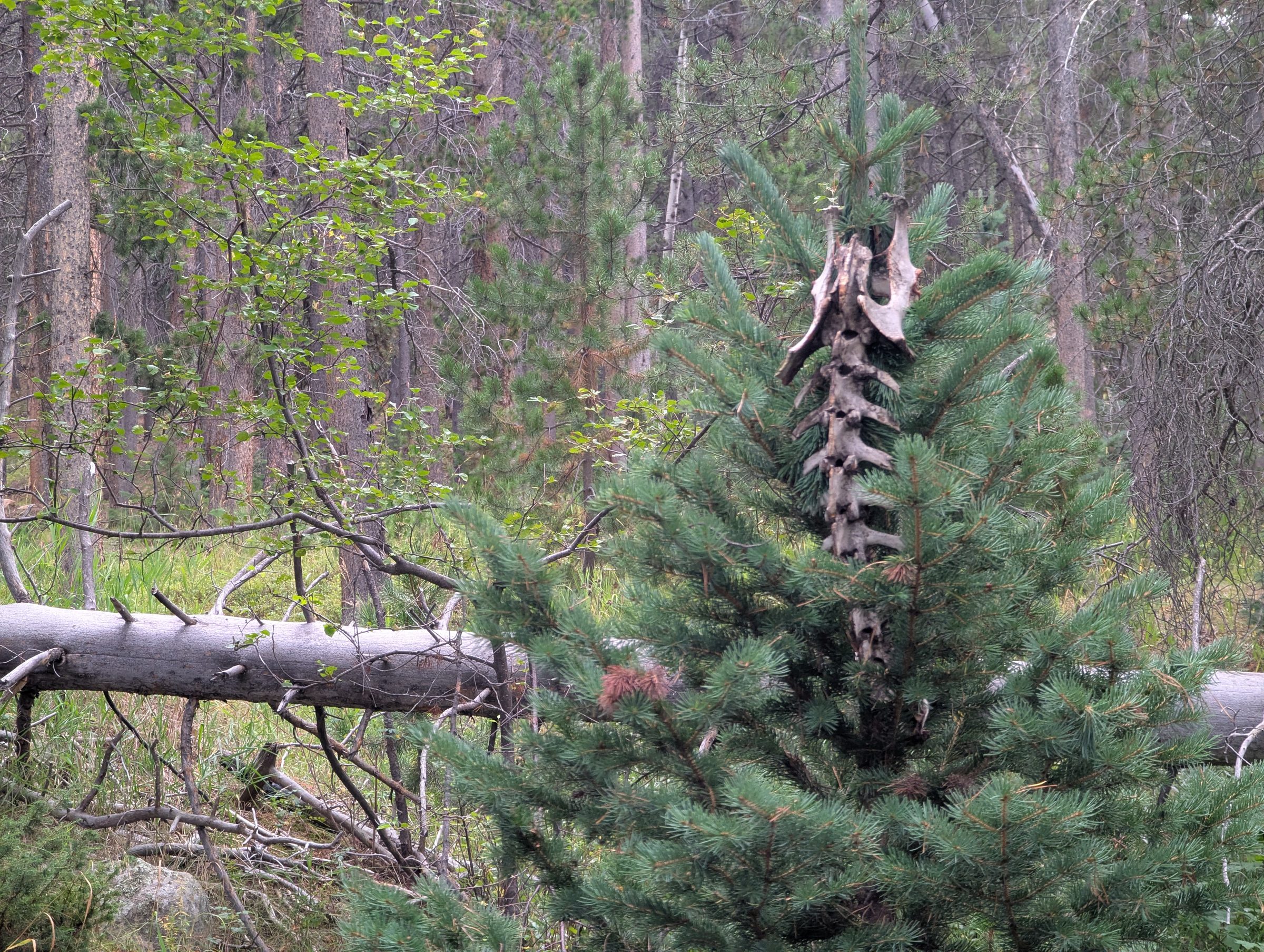
A dead deer that’s been covered up or hidden may be a lion’s kill. Leave the area.
Moose
Moose have spread along the Front Range since Colorado Parks and Wildlife reintroduced them, with sightings reported from Golden to Evergreen. They turn up around here too. Locals know two of them well enough to have named them “Maximus Moosimus” and “Mini Max.”
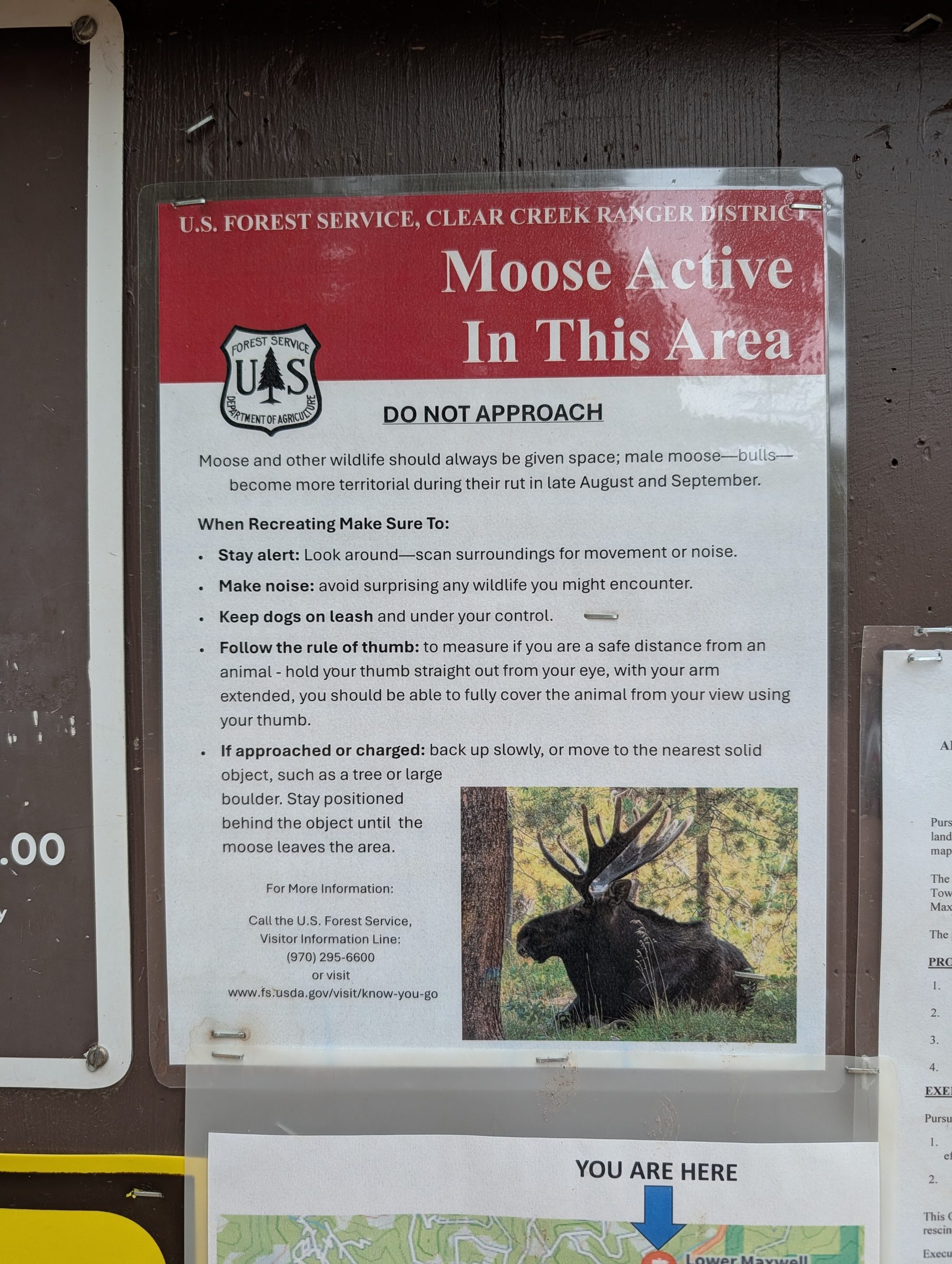
The Clear Creek Ranger District posts a notice at the trailheads that reads “Moose active in this area. Do not approach” (posted at the trailhead in September 2026). It warns that moose get more territorial during their rut in late August and September, and asks you to stay alert, make noise and keep dogs leashed. Its rule of thumb: hold your thumb out at arm’s length, and if it doesn’t fully cover the moose, you’re too close. If a moose approaches or charges, back away slowly or get behind a tree or large boulder until it leaves. The district’s visitor information line is (970) 295-6600.
They’re great to see, and they are not pets. Give a moose far more room than you’d give a deer. A moose is more dangerous to your dog than a bear is: CPW explains that “moose react to dogs as they would a wolf, one of their primary predators,” and many moose conflicts involve dogs.
Keep your dog leashed and close, and turn around if a moose is on or near the trail. CPW puts it simply: “If a moose reacts to your presence, you are too close.” Watch for ears laid back, raised hair on the neck and a lowered head. If one does charge, get a tree, boulder or car between you and it.
Colorado Parks and Wildlife has more on living with bears, mountain lions and moose.
Leave No Trace
The original Friends of Maxwell Falls site started from one idea: leave this place as clean and wild as we found it. The seven Leave No Trace principles map onto Maxwell Falls pretty directly:
- Plan ahead and prepare. Check conditions, know the rules, and pick the right route.
- Travel on durable surfaces. Stay on the signed trail. Social trails erode the canyon.
- Dispose of waste properly. There’s no trash service at any trailhead; the signs say “No garbage service. Please pack it out!” Pack out everything, every dog-waste bag included, and carry the bags home rather than leaving them at the trailhead. There are no restrooms, so go before you come.
- Leave what you find. Take only photos. Don’t stack rocks, pick flowers or carve trees. Moving rocks can speed erosion.
- Minimize campfire impacts. At Maxwell Falls that’s easy: no campfires, ever. If you want a hot drink, a gas stove on bare ground is fine; charcoal grills aren’t allowed under Stage 1.
- Respect wildlife. Watch from a distance, and never feed animals.
- Be considerate of other visitors. Share the trail, keep music off, step aside for uphill hikers, and keep your dog close when passing.
Clean your boots
A handful of weedy, non-native plants such as mullein, toadflax and Canada thistle grow along the trail. Brushing off your boots and your dog before and after the hike helps keep them from spreading.
Accessibility
Maxwell Falls is not accessible for wheelchairs or strollers. The trails are dirt, with roots, rocks, loose gravel, creek crossings and short grades of up to about 25%. Neither trailhead has restrooms or accessible facilities. The upper route is the shortest option, at about 0.6 miles each way.
Is there cell service at Maxwell Falls?
It's spotty for many carriers, in the canyon and along the roads, and even 911 may not connect. Text 911 if a call fails (Jefferson County accepts texts), move to higher ground such as Meditation Rock on the Cliff Loop, and carry an offline map.
Is Maxwell Falls safe for kids?
Yes, with supervision. Keep kids off the wet rocks around the falls and back from the edges on the Cliff Loop.
Are there bears or mountain lions at Maxwell Falls?
Both live here. Bears are most active in late summer and early fall as they feed before hibernation, and neighbors have found lion kills off-trail. Stay on the trail, pack away food, keep dogs leashed and kids close.
Are there moose at Maxwell Falls?
Yes, moose are seen in the area, and the Forest Service posts a moose notice at the trailheads. They're more territorial during the rut in late August and September. Give them lots of room (your thumb at arm's length should cover the whole animal) and keep dogs leashed and close: moose treat dogs like wolves, and they're more dangerous to dogs than bears are.
Is shooting allowed near Maxwell Falls?
No. A permanent Forest Service order prohibits recreational shooting here. Licensed hunters are exempt, so wear a bright layer in fall. Rules.
Can I walk back to the other trailhead on the road?
Please don't. It's 2.8 miles with no shoulder along much of the route, 25–30 mph traffic on blind curves, and spotty cell data. Hike out and back, use two cars, or do a loop.
Is the creek water safe to drink?
Not without treating it. Bring all the water you'll need; there's none at the trailheads.
Sources
- Alpine Rescue Team: About
- Evergreen Fire/Rescue
- Denver7: Evergreen Fire/Rescue carries dehydrated dog off Maxwell Falls trail (2018)
- Jefferson County: Parking (JEFFCOM non-emergency line)
- Leave No Trace: The 7 Principles
- iNaturalist observations near Maxwell Falls
- Raising Hikers: Frozen waterfall hike with kids near Denver (creek ice)
- Hiking Project: Maxwell Falls Loop (grades)
- Colorado Parks and Wildlife: Living with Bears
- Colorado Parks and Wildlife: Living with Mountain Lions
- Colorado Parks and Wildlife: Living with Moose
- Denver7: Moose sightings increase in Jefferson County
- City of Arvada: Text to 911 in Jefferson County
- Alpine Rescue Team: Mountain Safety
- USFS: Permanent Recreational Shooting Order 02-10-00-25-02